
Dry conditions continue to occur across Puerto Rico and the U.S. Virgin Islands, raising concerns about drought, brush fires, and elevated fire danger. While a weak tropical wave may bring a slight chance of showers between Wednesday and Thursday, widespread rainfall is not expected for most areas.
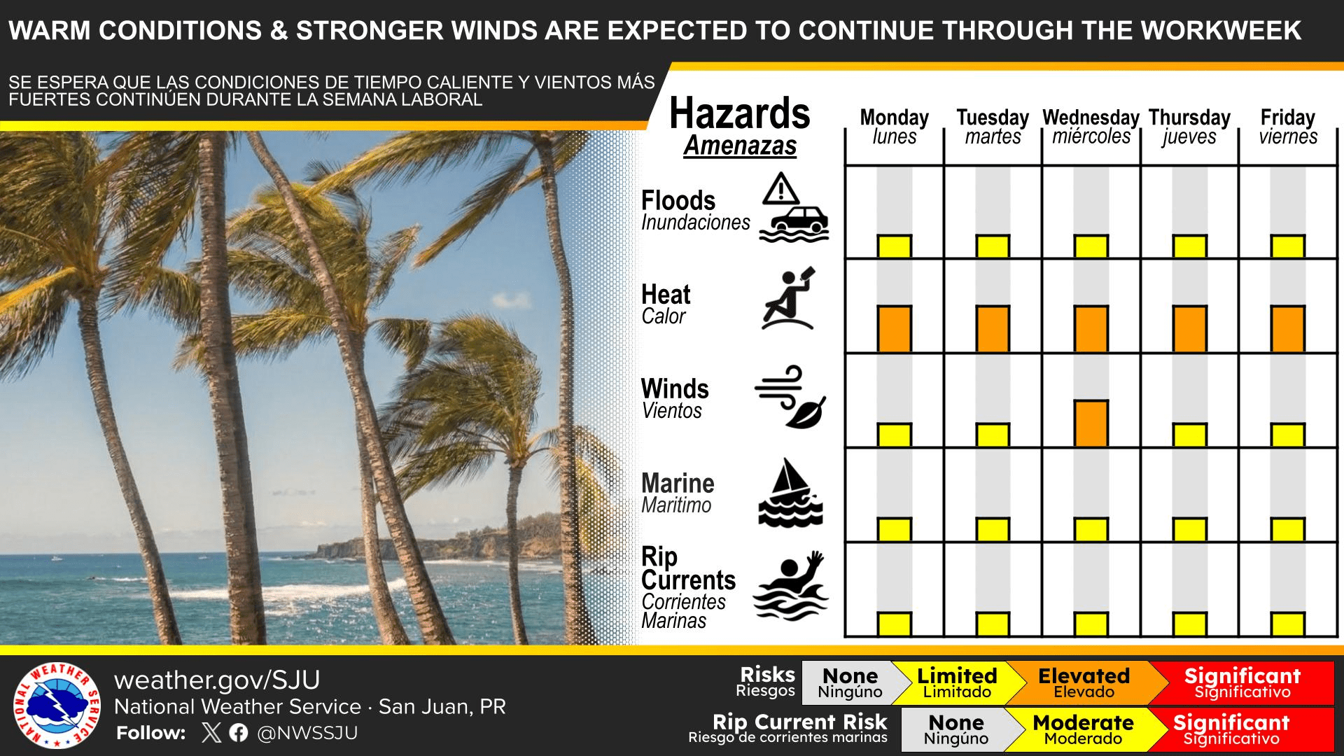
The local forecast also includes Saharan dust, hazy skies, gusty winds, and continued heat concerns, according to the National Weather Service in San Juan, Puerto Rico.
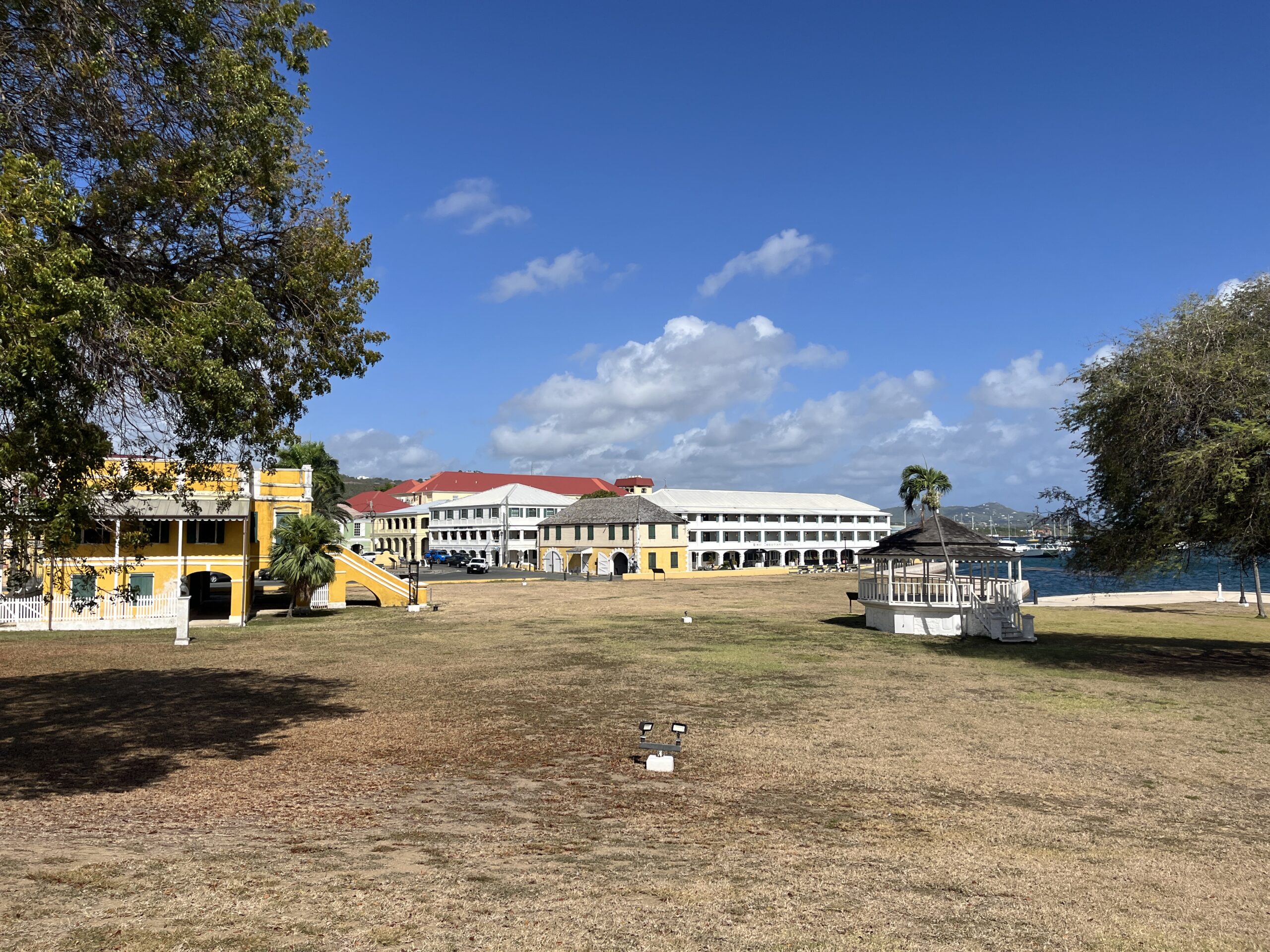
Dry Conditions and Drought Concerns
The ongoing dry pattern has become a growing concern across the region. Emanuel Rodríguez-González, service hydrologist at the NWS in San Juan, told the Source that conditions have been worsening.
“Drought conditions are deteriorating across Puerto Rico and the Virgin Islands,” Rodríguez-González said on Monday. “In Puerto Rico, vegetation stress is increasing quickly, with much of the grass and bushes looking yellow to brown. Brush fires are also increasing, with nearly 200 reports in the last couple of days,” he continued.
“While the primary reservoirs are healthy, some small water intakes, and wells and rivers are losing water. There are also some impacts to agricultural services,” Rodríguez-González confirmed.
Throughout the U.S. Virgin Islands, dry vegetation and dropping water levels in some monitored wells are also occurring.
“Across the Virgin Islands, aside from a poor Vegetation Health Index, wells monitored by the United States Geological Survey are losing water. It is likely that some impacts to agriculture and an increase in grass fire frequency can be anticipated,” Rodríguez-González explained.
Although very brief showers were observed across parts of the islands on Tuesday, the NWS issued a Fire Danger Statement for portions of southern and southwestern Puerto Rico, Vieques, and St. Croix, citing critically dry conditions, gusty winds, and low humidity.
According to the NWS, those conditions could allow fires to spread quickly if they develop. As the Source previously reported, a territory-wide burn ban is currently in effect across the USVI.
Slight Rain Chance, But Moisture May Stay South
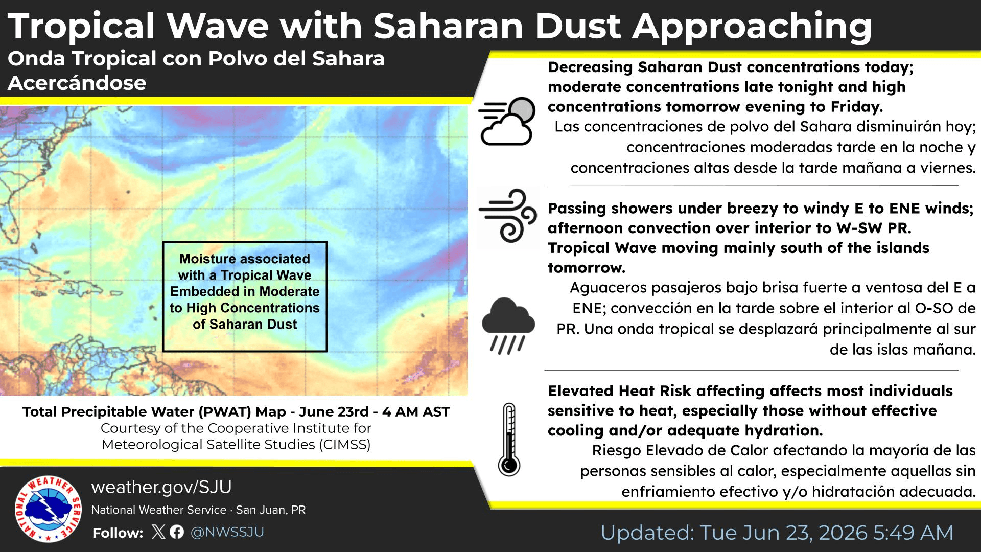
The NWS noted that a tropical wave passing through the Caribbean may provide a slight chance of precipitation, but rainfall could remain limited.
The NWS explained that most of the moisture associated with the tropical wave is expected to remain south of Puerto Rico and the USVI. Dry air, Saharan dust, and warm temperatures aloft may also limit shower and thunderstorm development.
Rodríguez-González said that tropical waves that pass through the region may provide some respite, but the broader pattern could continue for months.
“Tropical waves will arrive periodically, bringing some relief to the drying conditions. However, climate models show this dry pattern will likely continue through the end of the year,” Rodríguez-González said.
The longer-term outlook remains important, especially if rainfall continues to underperform during the coming months. Rodríguez-González pointed to the current El Niño pattern which can influence the odds of drought across the area.
“While El Niño alone does not directly cause a drought, a stronger El Niño will increase the odds of drought conditions developing or worsening across the northeastern Caribbean,” Rodríguez-González stated.
He also noted that additional drought information may be released soon.
Saharan Dust and Gusty Winds
The amount of Saharan dust in the atmosphere is expected to increase starting on Wednesday.
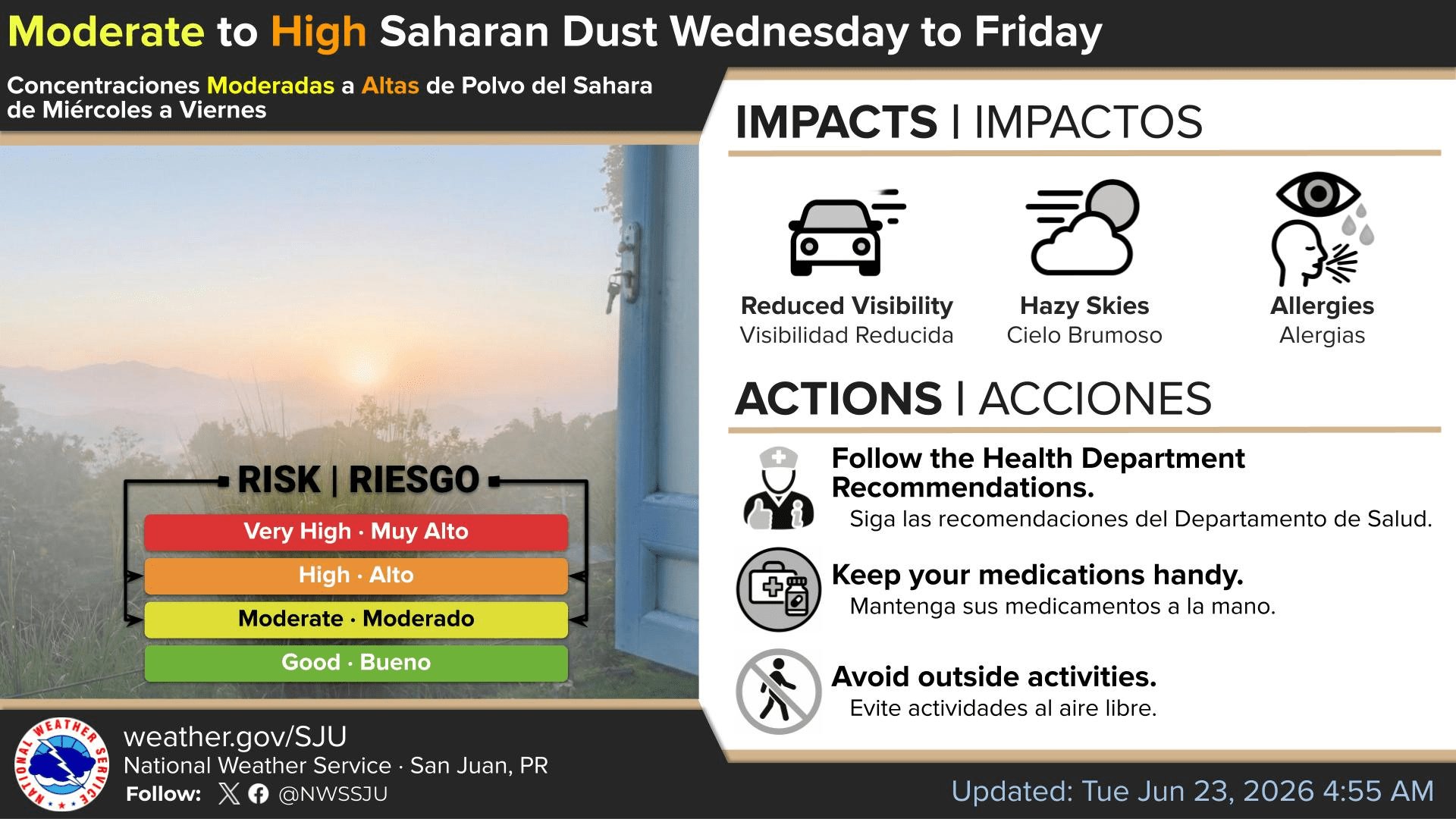
The NWS said moderate to high concentrations of Saharan dust are expected to arrive by late Wednesday afternoon and continue through Friday, resulting in hazy skies, reduced visibility, and deteriorated air quality.
Breezy conditions are also expected to continue, with gusts possible across portions of the region. The NWS noted that sustained winds of 15 to 20 mph with gusts up to 30 mph were among the factors contributing to elevated fire weather concerns.
The gusty winds will also generate choppy seas, leading to an elevated risk of rip currents across Puerto Rico and the USVI.
While the dry, dusty, and hot conditions have been noticeable, Rodríguez-González said this year’s dust and heat do not appear unusually high compared with typical climatology for this time of year.
Atlantic Basin Quiet, Pacific Still Active
While tropical waves are being closely monitored in the Atlantic basin, the National Hurricane Center is not expecting tropical cyclone development across the Atlantic over the next seven days. However, the eastern and central Pacific remain active.
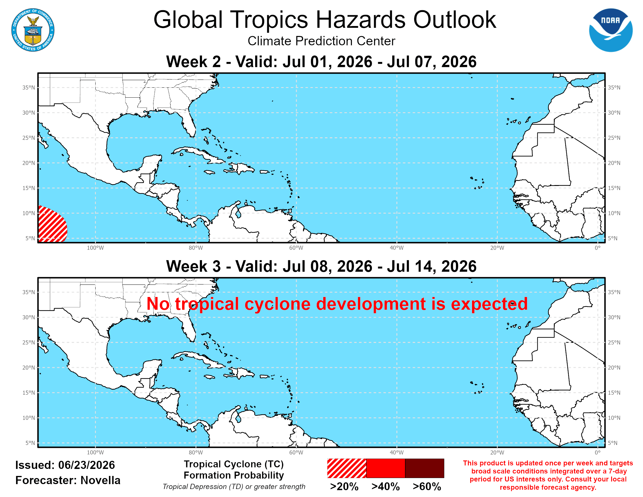
According to NOAA’s Global Tropics Hazards Outlook released Tuesday, June 23, the Atlantic basin is expected to remain relatively quiet through the coming weeks and into early July. Meanwhile, portions of the Pacific may see additional tropical cyclone activity, particularly during the first part of July. The outlook, issued each Tuesday by NOAA’s Climate Prediction Center, provides guidance on potential tropical activity across global basins up to three weeks in advance.
Local Updates
For now, there are no immediate tropical cyclone threats to Puerto Rico or the U.S. Virgin Islands, but residents are encouraged to follow the local forecasts, especially as dry conditions, Saharan dust, gusty winds, and limited rain chances remain part of the weather pattern. Heat alerts may be issued across both U.S. territories as temperatures remain high.
Information regarding the weather across the USVI is available from the NWS, the NHC, and NOAA. Details about current drought conditions can be located on the website of the National Integrated Drought Information System.
Additionally, the local forecast is regularly updated on the Source Weather Page, and a weekly video forecast is available. Residents and visitors can view weather alerts and disaster preparedness information from VITEMA.


