



Colorado State University has lowered its forecast for the 2026 Atlantic hurricane season again, now calling for well below-normal activity, as a strengthening El Niño is expected to help suppress tropical development across the Atlantic basin.
CSU’s July Update
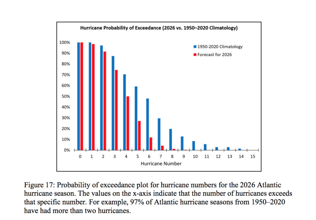
In its latest forecast update released on Wednesday, CSU’s Tropical Cyclones, Radar, Atmospheric Modeling, and Software Team predicted nine named storms, including four hurricanes and one major hurricane of Category 3 strength or higher.

That number is lower than the university’s June forecast, which called for 11 named storms, including five hurricanes and two major hurricanes. CSU’s initial April outlook predicted 13 named storms, six hurricanes and two major hurricanes. The latest forecast is also below the 1991-2020 seasonal average of 14.4 named storms, 7.2 hurricanes and 3.2 major hurricanes.
In its July update, CSU explained that the forecast reduction is tied largely to increasing confidence that El Niño will strengthen during the peak months of the Atlantic hurricane season. The season runs from June 1 through Nov. 30, with the historical peak typically occurring from mid-August through October.
“We further reduce our 2026 Atlantic basin hurricane season forecast and now anticipate a well below-normal season,” CSU stated in the report.
“Moderate El Niño conditions are likely to intensify over the next few months, with a high potential for a strong El Niño for the peak of hurricane season,” the CSU update said. “Sea surface temperatures across the Caribbean and tropical Atlantic are near their long-term averages. We anticipate the powerful El Niño being the dominant factor for the upcoming hurricane season, driving high levels of tropical Atlantic vertical wind shear. We are forecasting a well below-average probability for major hurricane landfalls along the continental United States coastline and in the Caribbean,” CSU continued.
El Niño Weather Pattern and Tropical Activity
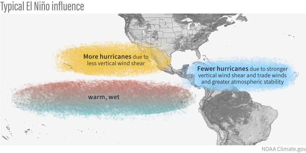
El Niño, which involves warmer-than-normal water in the central and eastern equatorial Pacific, typically increases wind shear across parts of the Caribbean and tropical Atlantic. Wind shear, or a change in wind speed and direction with height in the atmosphere, can disrupt tropical systems and make it more difficult for storms to form, organize, and strengthen.
However, during an El Niño event, while wind shear frequently increases across the Atlantic, it usually decreases across the central and eastern Pacific, which can allow for more cyclones to form. Forecasts have predicted an above-average hurricane season in the Pacific. Farther west in the western Pacific region, tropical activity has also been very busy. As of Thursday, Super Typhoon Bavi was moving toward Taiwan and China after causing major destruction throughout the Commonwealth of the Northern Mariana Islands, and Guam.
Even with CSU’s lowered outlook, residents are encouraged to continue reviewing hurricane plans, checking emergency supplies, and staying aware of forecast updates throughout the season.
“As with all hurricane seasons, coastal residents are reminded that it only takes one hurricane making landfall to make it an active season,” CSU said. “Thorough preparations should be made every season regardless of predicted activity,” the group advised.
CSU is scheduled to release another forecast update on Aug. 5. Residents can follow CSU’s tropical updates on the university’s official website.