

 Tropical storm force winds – that is, winds between 39 and 73 miles per hour – are expected across St. Croix Wednesday, as Tropical Storm Dorian moves through the region.
St. Croix can expect tropical storm force winds beginning at 8 a.m. and lasting to 3 p.m. Wednesday with estimated peak winds of 55 miles per hour, affecting the island at around 11 a.m.
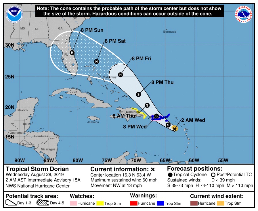
The storm center is forecast to pass 21 miles southwest of St. Croix late Wednesday morning, at which time Dorian will be a strong tropical storm with winds between 60-65 miles per hour.
Reports from an Air Force Hurricane Hunter aircraft indicated that Dorian had not strengthened as of 11 p.m. Tuesday, according to the National Hurricane Center. Additionally, as of 11 p.m. Tuesday, the initial intensity remained near 45 knots.

A tropical storm warning and a flash flood watch are in effect.
At 11 p.m., the center of Dorian was located near 16 degrees north and 63 degrees west, about 167 miles southeast of St. Croix. Top winds remained at 50 miles per hour while the storm continued on a northwesterly track at 13 miles per hour. Tropical storm force winds extend outward up to 45 miles from the center, and Dorian has the potential to leave one to three inches of rainfall on St. Croix.
The NHC reports that, since the storm has strong upper-level outflow over the western semicircle of the circulation and because vertical shear should remain low for the next day or two, strengthening is still forecast before Dorian reaches Puerto Rico on Wednesday.
Yet, some weakening is likely by 24 hours due to the interaction of the circulation with Puerto Rico. The intensity forecast in 3 to 5 days remains problematic because of a significant spread in the model guidance and some run-to-run inconsistencies.


