






Joshua Canning, a friend of mine, came by my office wanting to know some of the names of the trees and their botanical history at the newly established Maroon Sanctuary Territorial Park on the island of St. Croix. He is gathering information to write an article for the Source on trees of the park. As we held a discussion, Canning was impressed by the complexity and intricate nature of the forest ecosystem. What creates forest is the geological formation of the earth’s surface. This is Part 1 of a series.

This includes soil types, rainfall, topography, and the wind impact on the landscape. Of course, insects, plants, animals, microbes, and other living organisms are part of the interaction with the chemical and physical features of their environment. Specifically, a terrestrial environment dominated by trees growing in a closed canopy. Thus, a forest in other words.
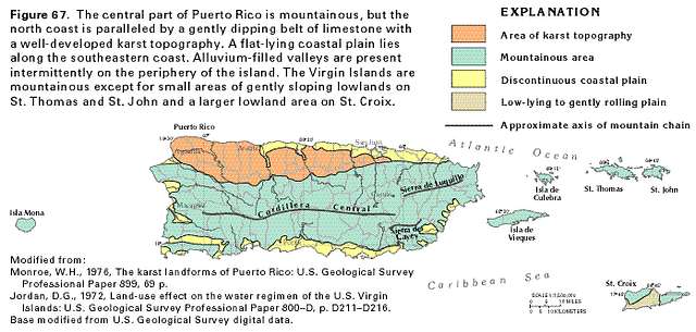
Geologically speaking, the Virgin Islands and Puerto Rico were once one landmass millions of years ago, according to geologists. This geological process influenced trees and animal species on the islands’ botanical forest development. Puerto Rico is the easternmost and smallest island of the Greater Antilles. It is bound on the south side by the Caribbean Sea and on the north side by the Atlantic Ocean.
The island land area is roughly 3,424 or 3,459 square miles. There are several small islands surrounding the island of Puerto Rico. On the west are Desecheo and Mona. The south includes many inlet cays and Caja de Muertos island. On the east is Culebra, Vieques, and the U.S. and British Virgin Islands. From the standpoint of geologic history, the small islands represent parts of the greater Puerto Rican land mass, now fragmented by subsidence and submergence in the ocean.
However, it is logical to treat the islands together as a botanical unit, because very few of the plants occurring on the smaller islands don’t grow on the mainland of Puerto Rico. On the other hand, there are plants endemic to Puerto Rico and the Virgin Islands and might not be found anywhere else in the world. This also goes for animal species like the native Virgin Islands Tree Boa (Chilabothrus grant) found on St. Thomas, Tortola, Culebra, and Mona Island, west of Puerto Rico, but not on the mainland of Puerto Rico.
Nevertheless, endemic simply means something is consistently present, found regularly, or native to a specific geographic area or population. Therefore, it is important to know the geological history that helps to explain present tree distribution in the Virgin islands and Puerto Rico. Puerto Rico and the adjacent islands began as submarine volcanoes on the ocean floor, according to geologists, some 125 million years ago and were built by the end of the Cretaceous period, which was about 80 million years ago.
One would say there was sufficient time through millenniums for much accidental migration of plants and animals from the landmass of Puerto Rico to have occurred to the adjacent islands. There is evidence geologists found that much higher mountain peaks may have existed, that blocks have been uplifted and subsided, and that sea level may have fluctuated during the early Cretaceous period. Another factor to consider is during the glacial periods the climate may have been cooler, vegetation zones as much as 3,000 feet lower, and sea level 200 feet lower.
The island of Puerto Rico, however, is of great geologic and topographic complexity. Although large parts of Puerto Rico are igneous in origin, it shouldn’t be called a “volcanic island.” Geologists believe because the volcanic events that affected Puerto Rico’s form and structure occurred many millions of years ago, it had enormous changes that occurred caused by erosion, accumulation of sedimentary deposits, uplift, tilting, submergence, faulting and folding of the island’s geological development.
Like the island of St. Croix, Puerto Rico divided into three physiographic areas. They are the coastal lowlands, the karst limestone along the northern side of Puerto Rico, and the upland region — geologic structure, which includes numerous small limestone outcrops, especially toward the southwest of the island. Then, there is the Sierra de Luquillo mountain range in the east of the island with a peak 1,640 feet above sea level.
El Toro Mountain range, at 3,526 feet, and El Yunque mountain, at 3,461 feet above sea level, also play a major role along with the more extensive Cordillera Central Mountain region forming the “backbone” of Puerto Rico’s highest peak, Cerro de Punta, at 4,390 feet above sea level. Whereas St. Croix also is divided into three parts like the landmass of Puerto Rico, we will focus in the northwest and northeast central region of St. Croix since we are discussing the forest development in Maroon Park.
First, if you noticed, there is a short ridge lying northwest and southeast and containing the highest peaks of St. Croix, namely Blue Mountain (1,096 feet) at its southern end and Mount Eagle (1,165 feet) at its northern end. These mountain ranges are the most conspicuous feature of St. Croix. Thus, they are an important feature of St. Croix’s geography. Intermittent streams in these high elevations drain into the deep cut valley of the forest on the eastern side and turn to the northeast (Mt. Eagle), and finally flow out by the stream known as Salt River Bay on the northern shore of the island.
On the western side are steep valleys, with the drainage turned southwards and flowing out on the southern shore of the island. Salt River Hills on the northeast is the highest point of which toward its east end is 872 feet above sea level. The spurs of this range press onto the sea shore, to reach the valley, which in part marks off the range from Mount Eagle Ridge. However, on the west side of Mount Eagle are low hills that connect with an extensive group block of hills than a range.
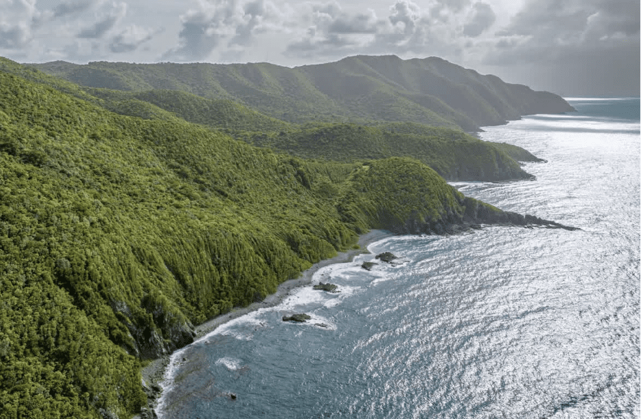
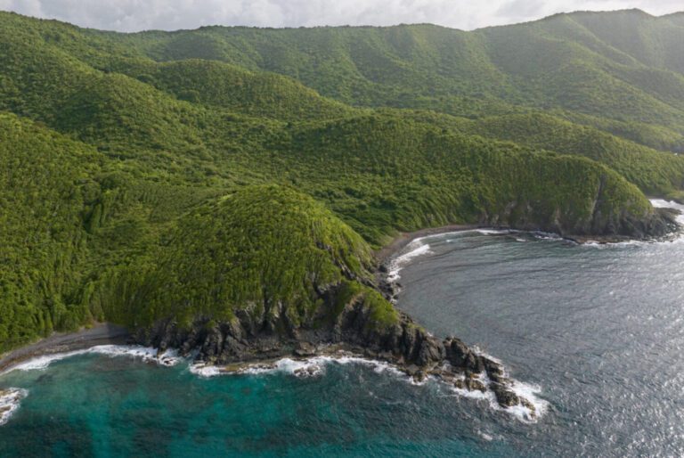
These blocks of hills are within the Maroon Sanctuary Park Forest that make up the northwestern corner of St. Croix, with some elevation over 800 feet and almost 1,000 feet above sea level. The rolling hills or low mountains of the northside of St. Croix of the western oblong are all connected by lower elevations and may be regarded as consisting of three parts within the Maroon Sanctuary Park.
The Mount Eagle Ridge, Salt River Hills to the east of that ridge, and the northwestern block of hills to the west of it, are the three dividing topographies in Maroon Country on St. Croix. Like Puerto Rico, St. Croix was never a volcanic island, but volcanoes played an indirect role in its formation. For this and other reasons, the forest development within Maroon Country plays a great role in species development of plants due to its higher elevation, more than any other part of the island.
The highest rainfall on St. Croix is within the Maroon Park. Estate Annaly is within the park with a rainfall of 50 to 60 inches of precipitation in a normal year. In Part 2 of this series, I will explain the forest development of Maroon Sanctuary Park.
— Olasee Davis is a bush professor who lectures and writes about the culture, history, ecology and environment of the Virgin Islands when he is not leading hiking tours of the wild places and spaces of St. Croix and beyond. Editor’s Note: Opinion articles do not represent the views of the Virgin Islands Source newsroom and are the sole expressed opinion of the writer. Submissions can be made to visource@gmail.com.

A civil suit filed in federal court last week accused Jeffrey Epstein’s “longest banking partner,” FirstBank Puerto Rico, of “participating in and financially benefiting from” the sex offender and disgraced financier’s international trafficking operation for more than two decades.
“As a result of FirstBank’s close multi-decade relationship with Epstein, FirstBank acquired a plethora of information regarding Epstein’s sex trafficking operation, information that could have put Epstein in prison years earlier if FirstBank had simply properly reported what it knew to authorities. Instead, it chose to profit to the detriment of hundreds of victims,” according to the complaint, which was filed last week in U.S. District Court for the Southern District of New York on behalf of a woman identified as Jane Doe. The anonymous plaintiff is represented by attorney David Boies, who has represented several survivors of Epstein’s abuse.
FirstBank’s parent company, First BanCorp, issued a statement Friday denying the accusations.
“The Corporation is reviewing the complaint and will respond through the appropriate legal channels,” according to the statement. “Given that litigation is pending, FirstBank will not be providing further comment at this time.”
The 91-page complaint alleges that FirstBank worked with Epstein from at least 1998 through 2020 and that it “knowingly provided” him with “the financial support and the veneer of institutional legitimacy.” One U.S. Treasury Department referenced in the complaint noted that from 2003-2019, there were more than 4,725 wire transfers — totaling $1.08 billion — involving Epstein and associates, including his attorney, Darren Indyke, accountants Harry Beller and Richard Kahn, and U.S. Virgin Islands tax attorney Erika Kellerhals.
Epstein used Kellerhals, according to the complaint, to organize shell entities, act as a trustee “for trusts that directly paid Epstein’s victims,” and to manage real estate transfers and transactions related to his private islands. Kellerhals also introduced Epstein during a V.I. Economic Development Commission hearing in 2012, during which he pitched a bizarre “biomedical and financial informatics” business to commissioners including current Economic Development Authority board member Jose Penn, the V.I. Public Finance Authority’s current director of finance administration, Nathan Simmonds, and the territory’s current governor, Albert Bryan Jr.
The complaint dedicates several paragraphs to the “U.S. Virgin Islands Context” of Epstein’s sex-trafficking activity. Epstein purchased Little St. James in 1998 and made the island his primary residence. Referencing the territory’s 2020 lawsuit against Epstein’s estate, which was ultimately settled for $105 million, the complaint argues that the “conduct catalogued in the USVI complaint — Epstein’s use of USVI-based entities to obscure trafficking activity, his payment of recruiters, his maintenance of a private aviation operation that flew victims to and from the islands, and the role of his entities and personnel in supporting that operation — is the same conduct FirstBank facilitated through its USVI and Puerto Rico banking operations.”
The plaintiff is seeking to certify a class of Epstein survivors as well as “punitive and exemplary damages” against FirstBank.
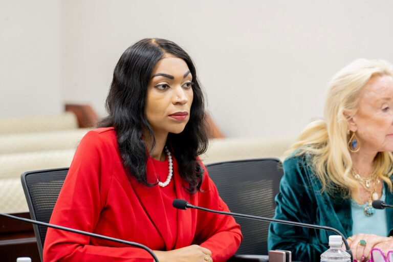
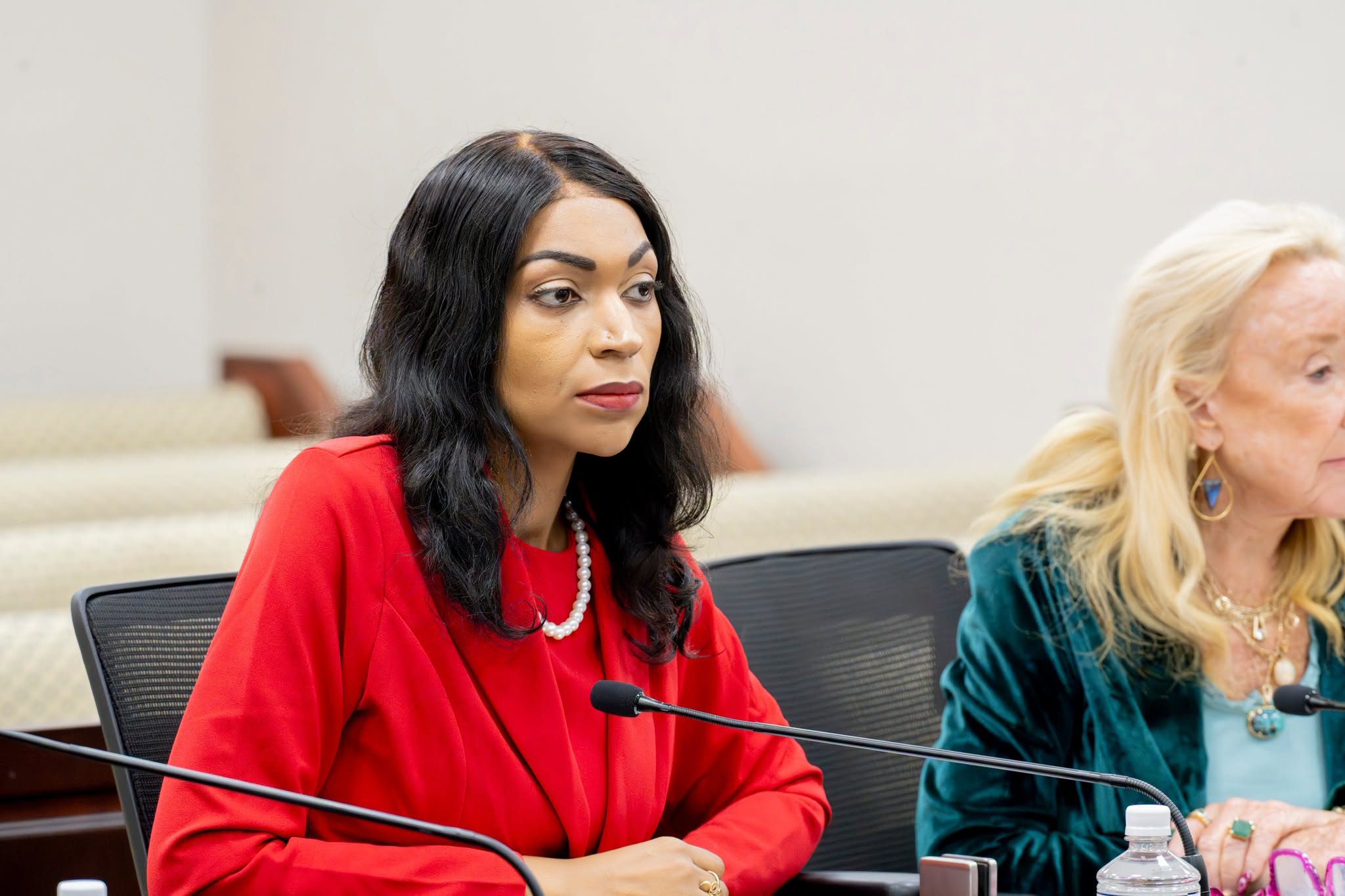
On Monday, the Senate Government Operations, Veterans Affairs and Consumer Protection Committee advanced a bill to rename a St. Croix road in honor of the late former Sen. Alicia “Chucky” Hansen.
Bill No. 36-0213 would rename Contentment Road on St. Croix as Senator Alicia “Chucky” Hansen Lane and appropriate $10,000 from the St. Croix Capital Improvement Fund for signage. The measure advanced unanimously and honors Hansen’s decades-long legislative career as a dominant independent voice known for utility regulation and hands-on constituent advocacy. The bill now moves to the Rules and Judiciary Committee.
The committee initially considered a proposal to rename Belvedere Road on St. Croix and fund signage. Sponsor Sen. Hubert L. Frederick told colleagues he and Hansen’s family had decided to offer an amendment to instead designate Contentment Road, which runs in front of the former Legislature building where Hansen carried out much of her extensive public service.
The committee later adopted an amendment offered by Sen. Franklin D. Johnson that renamed the road Senator Alicia “Chucky” Hansen Lane and directed the Public Works Department to install signage at both ends within 90 days after enactment.
Testifiers and senators described Hansen as one of the most respected figures in Virgin Islands politics. Elizabeth Hansen-Watley, assistant commissioner of the Tourism Department and the late senator’s daughter, said her mother was “the longest serving senator in Saint Croix history,” with “the highest votes for senator territorially” and “the most number one wins in the U.S. Virgin Islands history for senator,” all while serving as a “no-party independent candidate.”
Sen. Novelle E. Francis Jr. described her as “one of the most steady legislators over the years here in the Virgin Islands.” He said she was especially attentive to young people, recalling that she made calls to secure summer jobs and internships so “those individuals had a seat at the table.”
Testimony highlighted Hansen’s policy legacy, including sponsorship of a Freedom of Arbitration Act aimed at limiting mandatory arbitration in employment disputes. Attorney Lee J. Rohn of Lee J. Rohn & Associates, a friend of the late former senator, said Hansen also played a key role in a decades-long environmental case involving refinery-related dust in Western St. Croix, helping sustain the litigation over many years.
Speakers also tied Hansen to long-running debates over the Water and Power Authority. Hansen-Watley said her mother helped establish a $25 cap on reconnection fees and warned lawmakers about additional charges that could weaken that protection.
Sen. Ray Fonseca said Hansen “constantly” worked to protect ratepayers from rising electric bills, voted against allowing WAPA to bill customers for streetlights, and publicly called out the utility’s return to fuel oil when it could not pay its propane supplier, adding that WAPA is “right back” in a similar situation today and that “we need Chucky Hansen.”
Paul Payne, a friend of Hansen, described her as a hands-on advocate who intervened directly when residents lost water or electricity. “Senator Hansen was a fighter,” he said. “Every lion is a cat, but every cat is not a lion. Senator Hansen was a real lion.”
Rohn called Hansen “a force to be reckoned with” and “a barrier breaker,” noting her involvement in major policy fights and her national profile, including a speaking role at the Million Women’s March in Washington, D.C.
Sen. Franklin D. Johnson and Sen. Carla J. Joseph described Hansen as a mentor to newer lawmakers, recalling how she would call them after they joined the Legislature to offer insight, guidance and even small on-the-floor corrections.
Sen. Alma Francis Heyliger said Hansen’s example still shapes her own approach, noting that she often reminds herself that “if that fearless woman could do it, who am I to not defend the people of this territory?”
Frederick said the bill was revised after consultation with Hansen’s family and that Contentment Road was chosen because of its proximity to the former Legislature building, calling it a “particularly fitting tribute.”
Some senators questioned whether “Lane” adequately reflected Hansen’s stature, suggesting alternatives such as boulevard or highway, and raised whether formal honorifics should be included. Frederick said he was open to further refinement as the bill advances.
By the end of the hearing, lawmakers and witnesses framed the measure as both a symbolic recognition and a reminder of Hansen’s long record on utility regulation and environmental advocacy.
Hansen-Watley urged lawmakers to see the measure as part of her mother’s legacy, saying the people Hansen served “constantly remind me that she continues to live on in the hearts and minds of all of us” and urging them to “remember that a little bit of Alicia “Chucky” Hansen is in all of us. You just have to trust yourself.” She told senators that “the people come first” and asked them to carry forward her mother’s “people first, party second” approach.
The bill now advances to the Rules and Judiciary Committee for further consideration.
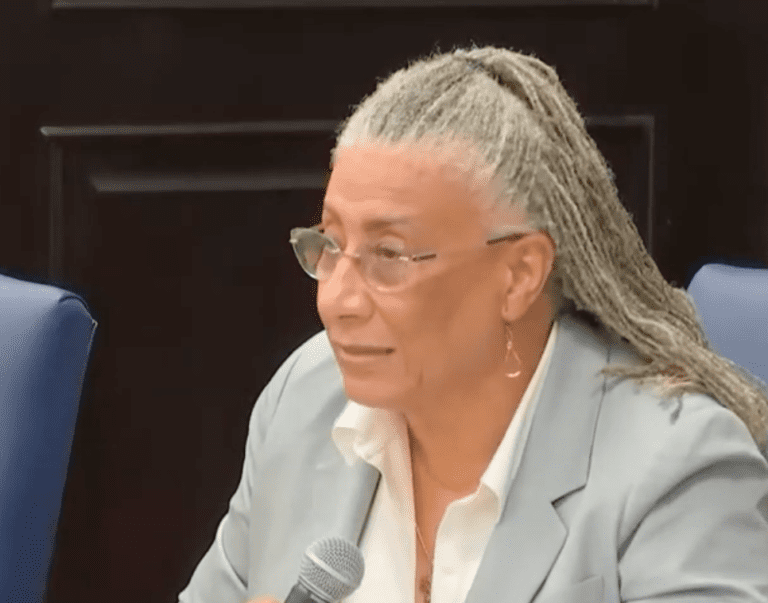
Lawmakers advanced two bills Monday to prevent government employees from losing retirement service credits because of loan defaults and to create a women veterans coordinator within the Office of Veterans Affairs.
The Senate Government Operations, Veterans Affairs and Consumer Protection Committee voted unanimously to send both measures to the Committee on Rules and Judiciary after hearing testimony, including from Government Employees’ Retirement System Administrator and Chief Executive Officer Angel E. Dawson Jr. and Veterans Affairs Director Patrick D. Farrell.
The first measure, Bill No. 36-0250, would amend Virgin Islands law to prohibit GERS from reducing, revoking or otherwise altering a member’s credited years of service because the member defaulted on a loan administered by the retirement system.
Years of credited service help determine when government employees can retire and what they receive in pension benefits. While the bill would bar GERS from reducing those credits because of a loan default, it would still allow the retirement system to collect unpaid debts through other lawful means.
Sen. Marise C. James, the bill’s sponsor, said the legislation was prompted by a constituent who worked for the government for 22 years before learning that nine years of credited service would not count toward retirement because she had defaulted on a GERS loan.
Although that situation was ultimately resolved, James said the Legislature should ensure future administrators cannot take similar action. She described the measure as “a bill that says to our public servants, your years of service cannot be erased because of a financial setback.”
Dawson testified that GERS previously used members’ retirement contributions to satisfy delinquent loans. Former employees who later returned to claim retirement benefits were then unable to restore those contributions, permanently reducing their credited service.
Dawson said the proposal would have no adverse financial impact because members seeking to restore their full service credit would first have to repay any retirement contributions previously applied to delinquent loan balances.
Sen. Kenneth L. Gittens questioned whether GERS ever had legal authority to reduce credited service because of loan defaults. Dawson pointed to the section of law allowing GERS to deduct unpaid loan balances from certain benefits, while legislative legal counsel said existing law does not expressly authorize the system to erase previously earned years of service.
Lawmakers also discussed problems involving government employers that deduct retirement contributions from employees’ paychecks but fail to remit those funds to GERS, leaving some workers unable to qualify for personal loans or with incomplete retirement records despite having deductions taken from their paychecks. Dawson said the retirement system depends on receiving those payroll deductions and cannot operate its loan program as if it were providing grants.
Several senators encouraged government employees to attend GERS retirement workshops and review their records several years before retiring to identify and resolve any discrepancies.
The committee adopted an amendment offered by Sen. Novelle E. Francis Jr. clarifying that GERS may continue collecting delinquent debts through lawful means but may not alter a member’s credited service because of a loan default. Senators then approved the amended bill on a 7-0 vote.
The committee also unanimously approved Bill No. 36-0279, sponsored by James, which would create a women veterans coordinator within the Virgin Islands Office of Veterans Affairs.
The coordinator would conduct outreach to women veterans and help connect them and their families with health care, housing, employment resources, disability claims assistance, mental health services and other federal and territorial benefits. James said the goal is to ensure “no woman veteran falls through the cracks simply because she does not know where to turn.”
James, a veteran, said women serve in every branch of the armed forces and, as a growing share of the veteran population, often face unique challenges, including military sexual trauma, women-specific health care needs and navigating complex benefits systems. She said the bill is about “recognizing that women veterans have unique needs and ensuring that the government is responsive to those needs.”
Farrell voiced strong support for the proposal, describing it as an investment in a growing population that, he said, has historically been underserved. He said nearly every state already has a similar position and that the Virgin Islands needs to catch up.
The hearing included discussion about how the position would be funded and whether it could legally be reserved for a woman veteran.
Farrell said the position is not currently included in the agency’s budget but estimated similar jobs nationally pay between $50,000 and $75,000 annually.
Legislative legal counsel advised senators that, under federal civil rights law, the position cannot legally be restricted to female applicants, even though it is intended to focus on issues affecting women veterans.
Despite those questions, the committee voted 7-0 to advance the measure, with lawmakers saying it would strengthen services for women veterans.
Farrell said the measure is meant to move Virgin Islands veterans “from being in the underserved category to being in the properly served category.”
Both bills were approved unanimously and now move to the Rules and Judiciary Committee for further consideration.



June 29, 2026
To: All Interested Agencies, Including the U.S. Army Corps of Engineers, Federal Emergency Management Agency (FEMA), Office of the Governor, U.S. Environmental Protection Agency Region II, National Oceanic and Atmospheric Administration (NOAA),
U.S. Fish and Wildlife Service, Virgin Islands Department of Planning and Natural Resources, Virgin Islands Territorial Emergency Management Agency, Virgin Islands Department of Public Works, Virgin Islands Economic Development Authority, Virgin Islands Port Authority, and all interested groups and individuals.
This is to give notice that the Virgin Islands Housing Finance Authority (VIHFA), as the Responsible Entity under 24 CFR Part 58, has determined that the following proposed action under the Community Development Block Grant–Mitigation (CDBG-MIT) Program, Grant No. B-18-DP-78-0002, is located in a floodplain, and VIHFA will be identifying and evaluating practicable alternatives to locating the action within the floodplain and the potential impacts on the floodplain from the proposed action, as required by Executive Order 11988, as amended by Executive Order 13690, in accordance with HUD regulations at 24 CFR 55.20, Subpart C, Procedures for Making Determinations on Floodplain Management and Protection of Wetlands.
The proposed Main Street Homes project is located at 80 Kronprindsens Gade, Charlotte Amalie, St. Thomas, U.S. Virgin Islands. The project involves the rehabilitation of a historic three-story building into nine (9) residential rental apartments. The historic structure sustained significant damage during Hurricanes Irma and Maria in 2017, including extensive damage to the roof and interior portions of the building. Although the building remains structurally intact, substantial rehabilitation is required to restore the structure for residential occupancy. The building previously contained residential units and retail space fronting Main Street.
The three-story structure consists of approximately 2,000 square feet on each floor, for a total of approximately 6,000 square feet. Upon completion, the building will contain nine (9) residential rental units, including one ADA-accessible apartment on the first floor. Each unit will include a bathroom, kitchen, and living area. The first floor will contain three studio apartments and a common laundry area with two washers and two dryers. The second floor will contain one one-bedroom apartment and two studio apartments. The third floor will contain two two-bedroom apartments and one studio apartment. Rehabilitation activities will occur within the existing building footprint and on the existing structure. No excavation, filling, grading, or other ground-disturbing activities are proposed. Solar panels will be installed on the existing roof to offset energy costs.
The apartments are designed to accommodate up to nine (9) families. The development is intended to increase the availability of resilient, hurricane-resistant, affordable rental
housing for residents of the U.S. Virgin Islands and will serve low- to moderate-income (LMI) households consistent with CDBG-MIT program objectives.
The project site is located along Main Street within the historic district of Charlotte Amalie. The subject building, constructed in 1848, is a three-story brick structure situated along Dronningsens Gade (Main Street). The building is U-shaped and contains a historic well within the interior courtyard.
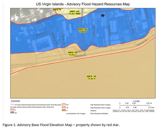
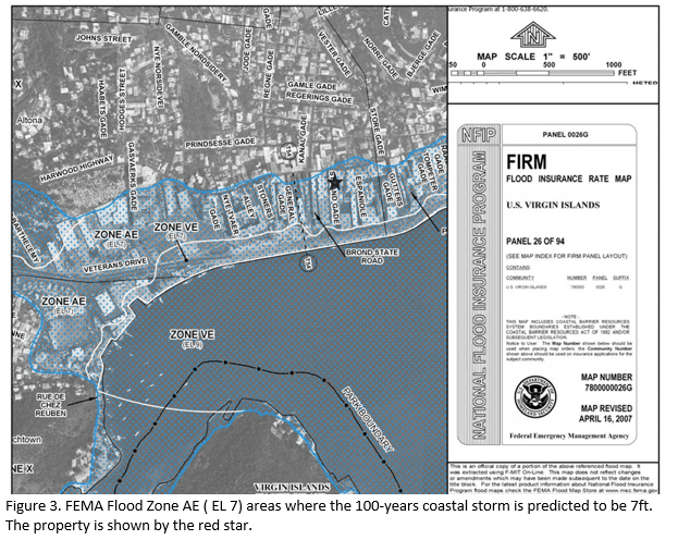
The area has been extensively altered from its historic condition and is fully developed. The property is relatively level and is located at an elevation of less than 10 feet above mean sea level near Main Street. The USDA Custom Soil Survey identifies the site as Urban Land (UbD), indicating that the area has been significantly modified and no longer retains its original soil characteristics. The property is located within FEMA Flood Zone AE, where the base flood elevation has been established at 7 feet according to FEMA Flood Insurance Rate Map (FIRM) Panel 26 of 94.
The property is fully developed and no filling, excavation, or earthwork activities are proposed. Existing finished floor elevations are approximately 9.5 feet above mean sea level, which exceeds the established base flood elevation of 7 feet.
There are three primary purposes for this notice. First, people who may be affected by activities in the floodplain and those who have an interest in the protection of the natural environment should be given an opportunity to express their concerns and provide information about this area. Commenters are encouraged to offer alternative sites outside of the floodplain, alternative methods to serve the same project purpose, and methods to minimize and mitigate project impacts on the floodplain. Second, an adequate public notice program can be an important public educational tool. The dissemination of information and request for public comment about the floodplain can facilitate and enhance Federal efforts to reduce the risks and impacts associated with the occupancy and modification of these special areas. Third, as a matter of fairness, when the Federal government determines it will participate in actions taking place in the floodplain, it must inform those who may be put at greater or continued risk.
Written comments must be received by VIHFA at the following address on or before July 14, 2026: VIHFA Virgin Islands Housing Finance Authority, 3202 Demarara Plaza, Suite 200, St. Thomas, VI, 00802-6447 and (340) 777-4432, Attention: Ms. Dayna Clendinen, Chief Disaster Recovery Officer, during the hours of 9:00 AM to 5:00 PM. Comments may also be submitted via email at media@vihfa.gov.
Regards, Dayna Clendinen Digitally signed by Dayna Clendinen Date: 2026.06.24 23:32:28 -04’00’ Chief Operating Officer Chief Disaster Recovery Officer Virgin Islands Housing Finance Authority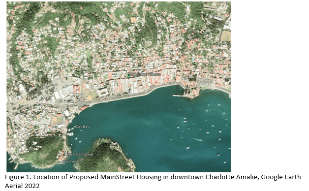
Aviso Temprano y Revisión Pública de una Actividad Propuesta en una Llanura de Inundación Designada
29 de junio de 2026
Para: Todas las agencias interesadas, incluyendo el Cuerpo de Ingenieros del Ejército de los Estados Unidos (U.S. Army Corps of Engineers), la Agencia Federal para el Manejo de Emergencias (FEMA), la Oficina del Gobernador, la Agencia de Protección Ambiental de los Estados Unidos, Región II (EPA), la Administración Nacional Oceánica y Atmosférica (NOAA), el Servicio de Pesca y Vida Silvestre de los Estados Unidos (U.S. Fish and Wildlife Service), el Departamento de Planificación y Recursos Naturales de las Islas Vírgenes, la Agencia Territorial para el Manejo de Emergencias de las Islas Vírgenes, el Departamento de Obras Públicas de las Islas Vírgenes, la Autoridad de Desarrollo Económico de las Islas Vírgenes, la Autoridad Portuaria de las Islas Vírgenes, así como todos los grupos e individuos interesados. Por medio de la presente se notifica que la Autoridad de Financiamiento para la Vivienda de las Islas Vírgenes (VIHFA), en calidad de Entidad Responsable conforme a 24 CFR Parte 58, ha determinado que la siguiente acción propuesta bajo el Programa de Subvención en Bloque para el Desarrollo Comunitario–Mitigación (CDBG-MIT), Subvención No. B-18-DP-78-0002, está ubicada en una llanura de inundación, y VIHFA identificará y evaluará alternativas viables para ubicar la acción fuera de la llanura de inundación, así como los posibles impactos de la acción propuesta sobre la llanura de inundación, según lo requerido por la Orden Ejecutiva 11988, según fue enmendada por la Orden Ejecutiva 13690, y de conformidad con los reglamentos de HUD establecidos en 24 CFR 55.20, Subparte C, Procedimientos para la Toma de Determinaciones sobre el Manejo de Llanuras de Inundación y la Protección de Humedales. El proyecto propuesto Main Street Homes está ubicado en 80 Kronprindsens Gade, Charlotte Amalie, St. Thomas, Islas Vírgenes de los Estados Unidos. El proyecto consiste en la rehabilitación de un edificio histórico de tres pisos para convertirlo en nueve (9) apartamentos residenciales de alquiler. La estructura histórica sufrió daños significativos durante los huracanes Irma y María en 2017, incluyendo daños extensos al techo y a las áreas interiores del edificio. Aunque la estructura permanece íntegra desde el punto de vista estructural, se requiere una rehabilitación sustancial para restaurarla para uso residencial. El edificio anteriormente albergaba unidades residenciales y espacios comerciales con frente a Main Street. La estructura de tres pisos consta de aproximadamente 2,000 pies cuadrados en cada nivel, para un total aproximado de 6,000 pies cuadrados. Una vez completado el proyecto, el edificio contendrá nueve (9) unidades residenciales de alquiler, incluyendo un apartamento accesible conforme a la Ley para Estadounidenses con Discapacidades (ADA) en el primer piso. Cada unidad contará con baño, cocina y área de estar. El primer piso contendrá tres apartamentos tipo estudio y un área común de lavandería con dos lavadoras y dos secadoras. El segundo piso contendrá un apartamento de un dormitorio y dos apartamentos tipo estudio. El tercer piso contendrá dos apartamentos de dos dormitorios y un apartamento tipo estudio. Las actividades de rehabilitación se llevarán a cabo dentro de la huella existente del edificio y sobre la estructura existente. No se proponen actividades de excavación, relleno, nivelación ni ninguna otra actividad que implique alteración del suelo. Se instalarán paneles solares en el techo existente para reducir los costos de energía. Los apartamentos están diseñados para alojar hasta nueve (9) familias. El proyecto tiene como objetivo aumentar la disponibilidad de viviendas de alquiler asequibles, resilientes y resistentes a huracanes para los residentes de las Islas Vírgenes de los Estados Unidos y atenderá a hogares de ingresos bajos y moderados (LMI), en consonancia con los objetivos del programa CDBG-MIT. El sitio del proyecto está ubicado a lo largo de Main Street dentro del distrito histórico de Charlotte Amalie. El edificio objeto del proyecto, construido en 1848, es una estructura de ladrillo de tres pisos situada a lo largo de Dronningsens Gade (Main Street). El edificio tiene forma de U y contiene un pozo histórico en el patio interior. El área ha sido ampliamente modificada con respecto a sus condiciones históricas y se encuentra completamente desarrollada. La propiedad es relativamente plana y está ubicada a una elevación inferior a 10 pies sobre el nivel medio del mar cerca de Main Street. El Estudio Personalizado de Suelos del USDA identifica el sitio como Terreno Urbano (UbD), lo que indica que el área ha sido significativamente modificada y ya no conserva sus características originales de suelo. La propiedad está ubicada dentro de la Zona de Inundación AE de FEMA, donde la elevación base de inundación se ha establecido en 7 pies de acuerdo con el Mapa de Tasas de Seguro contra Inundaciones (FIRM) de FEMA, Panel 26 de 94. La propiedad está completamente desarrollada y no se proponen actividades de relleno, excavación ni movimiento de tierra. Las elevaciones terminadas existentes del piso son aproximadamente 9.5 pies sobre el nivel medio del mar, lo que excede la elevación base de inundación establecida de 7 pies. Existen tres propósitos principales para este aviso. En primer lugar, las personas que puedan verse afectadas por actividades dentro de la llanura de inundación, así como aquellas que tengan interés en la protección del medio ambiente natural, deben tener la oportunidad de expresar sus inquietudes y proporcionar información sobre esta área. Se invita a los comentaristas a proponer ubicaciones alternativas fuera de la llanura de inundación, métodos alternativos para lograr el mismo propósito del proyecto y medidas para minimizar y mitigar los impactos del proyecto sobre la llanura de inundación. En segundo lugar, un programa adecuado de notificación pública puede ser una importante herramienta educativa para el público. La difusión de información y la solicitud de comentarios públicos sobre la llanura de inundación pueden facilitar y fortalecer los esfuerzos federales para reducir los riesgos e impactos asociados con la ocupación y modificación de estas áreas especiales. En tercer lugar, por razones de equidad, cuando el Gobierno Federal determina que participará en acciones que se llevarán a cabo dentro de una llanura de inundación, debe informar a aquellas personas que puedan estar expuestas a un riesgo mayor o continuo. Los comentarios por escrito deberán ser recibidos por VIHFA en la siguiente dirección a más tardar el 14 de julio de 2026: Virgin Islands Housing Finance Authority (VIHFA), 3202 Demarara Plaza, Suite 200, St. Thomas, VI 00802-6447, teléfono (340) 777-4432, Atención: Sra. Dayna Clendinen, Directora de Recuperación ante Desastres, en horario de 9:00 a.m. a 5:00 p.m. Los comentarios también podrán enviarse por correo electrónico a media@vihfa.gov.
Regards, Dayna Clendinen Dayna Clendinen Digitally signed by Dayna Clendinen Date: 2026.06.24 23:31:09 -04’00’ Chief Operating Officer Chief Disaster Recovery Officer Virgin Islands Housing Finance Authority


Since 1999 the Virgin Islands Source – the only online newspaper of general circulation in the U.S. Virgin Islands – has been providing the community with reliable, accurate and balanced local journalism.
Contact us: visource@gmail.com
© 1999-2025 Virgin Islands Source