

This is the second in a series of articles to educate the Virgin Islands public about the preservation and protection of establishing a Maroon Territorial Park on the northwest quarter of St. Croix. The history of the northwest of St. Croix begins before it was first inhabited. The geological history of the island, according to geologists, goes back to 80 million years ago. Although St. Croix is not a volcanic island, volcanos played an indirect role in its formation.
For this reason, the northwest of the island is unique with its rugged topography rising from the ocean floor over 1,000 feet above sea level. St. Croix is separated from the northern Virgin Islands by what is known as the Virgin Islands Basin. Off the north coast of St. Croix, its trenches plunge 15,000 feet deep where the South American and Caribbean plates meet. The hills and mountains of the northwest have many narrow, steep-sided valleys and intermittent streams with cliffs meeting the ocean floor.
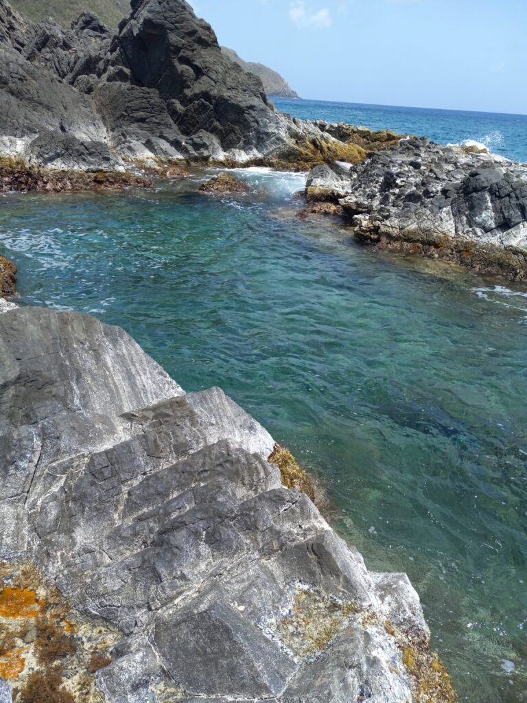
Along the coast of the northwest, there is a reef system that is several million years old that deposited on the black Caledonia volcano bedrock. This reef formation is uplifted to form a very large seaward barrier reef system from Wills Bay, Wells Bay, Annaly Notch, and Annaly Bay that created several deep water tidepools, some 12 to 13 feet deep. Above these tidepools are stunning formations of eroded and jagged corals and black rock formations.
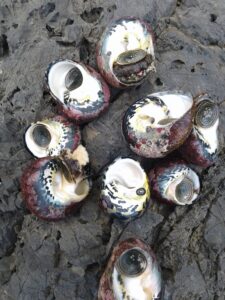
The northwest coastal water from Sweet Bottom Bay to Ham’s Bluff is probably the only area on St. Croix that has never been impacted by paved roads, houses, telephone poles, etc. Believe me, it is a wilderness unto itself. The marine environment is a paradise. It is a thriving ecosystem with many types of corals and diverse forms of sea life. The surrounding waters of the northwest bays are deep, with breathtaking views of sunsets and, on the distant horizon, the northern Virgin Islands and Puerto Rico. Historically, Annaly Bay is well known for its large whelk and lobsters. The area is a fisherman’s paradise, especially for line fishing.

More than 4,000 years ago, distinct groups of Amerindians migrated, traveling up the Antillean chain from South America. They left evidence of their culture on St. Croix. Along the coastal environment of Annaly Bay, Wills Bay, and Sweet Bottom Bay are prehistoric-Columbian sites. In prehistoric and early colonial periods, the forest of the northwest was lush with large trees towering toward the blue sky. In fact, the Dutch called the northwest forest of St. Croix “no man land,” which means dense forest land.
Although plantation owners knew of “Maroonberg,” which means hill or mountain and is now known as Maroon Ridge on the northwest, it was the only area on the island not surveyed in Beck’s historic 1754 map, which was the first Danish-commissioned map of St. Croix. Instead, the area was labeled as “Uoptagne Grunde.” Beck and other surveyors would have feared the encounter of Maroons in the dense tropical forest of the northwest.
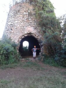
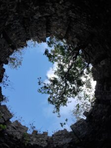
The only remaining virgin forest on St. Croix is on the northwest of the island. The native forests along the coast are very steep. These areas have never been cultivated or deforested. However, the upland mountain forests were cultivated. The first sugar mill appeared in the area in 1796 at Estate Wills Bay. The second sugar mill was built in 1808. Bodkin Mill is the highest mill on the island with a spectacular panoramic view of St. Croix, with almost a 360-degree view from a 960-foot elevation.
According to the statistics of sugar production in St. Croix from 1862 to 1889, Bodkin, Wills Bay, and Sweet Bottom Bay went out of sugar cultivation from 1896. These estates are within the northwest quarter. For more than 126 years, the mountain ranges of the northwest have not been cultivated. There are several types of forests within the northwest watershed with rare, endangered, threatened and endemic plants species.
The northwest forests also have rare animals, such as the Bridled quail-dove (Geotrygon mystacea). This bird was endangered since the 1800s and almost went extinct due to the importation of the mongoose in 1883 and the deforestation of the upland mountain forest. These birds are only found in the northwest and upper northeast forest of St. Croix. In other word, they are forest birds.
However, the rarest bird is our native owl (Nudipes newtoni). For more than 50 years, the late naturalist George A. Seaman searched for that one bird and never saw our Little Screech Owl. On the night of Nov. 25, 1966, Seaman heard the bird making noise in an almond tree while he and his best friend, Harry Beatty, were camping in the deep forest of the northwestern side of St. Croix.
According to Seaman’s account, “Harry spoke: ‘George,’ he hissed, ‘that’s it, that’s it. That’s an owl, listen.’ Sure enough, after about a minute again there came the distant ‘hoo-hoo-hoo.’ To say that I was thrilled is not enough. To hear this rare bird calling from deep in the woods on a glorious moonlight night after more or less a life span of patient watching and listening, well, I can assure you it was to me like finding a Spanish galleon full of gold. I tell you, at that moment if the world had come to an end I couldn’t have cared less!”
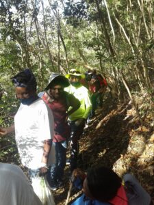
More than 20 years ago, I happened to see an owl on a moonlit night deep in the valley of Sweet Bottom Bay. I just happened to stumble on the bird. There are several old slave dirt roads in the forest of the northwest. Believe me, whenever you walk these historic dirt roads, your hair on your body stands up. It is something to experience for yourself. I will tell you sometimes you want to cry, for the spirit of the Maroons is strong.
The fog that covers the northwest mountains during a thunderstorm and the hundreds of soldier crabs that migrate to the ocean is another once-in-a-lifetime island experience. Without a doubt, the northwest Maroon country has the criteria to become a World Heritage Site.
– Olasee Davis is an Extension Professor/Extension Specialist in Natural Resources at the University of the Virgin Islands who writes about the culture, history, ecology and environment of the Virgin Islands when he is not leading hiking tours of the wild places and spaces of St. Croix and beyond.
Editor’s Note: The first column in this series, “Join the Call for a Maroon Territorial Park,” was published on June 17.


