
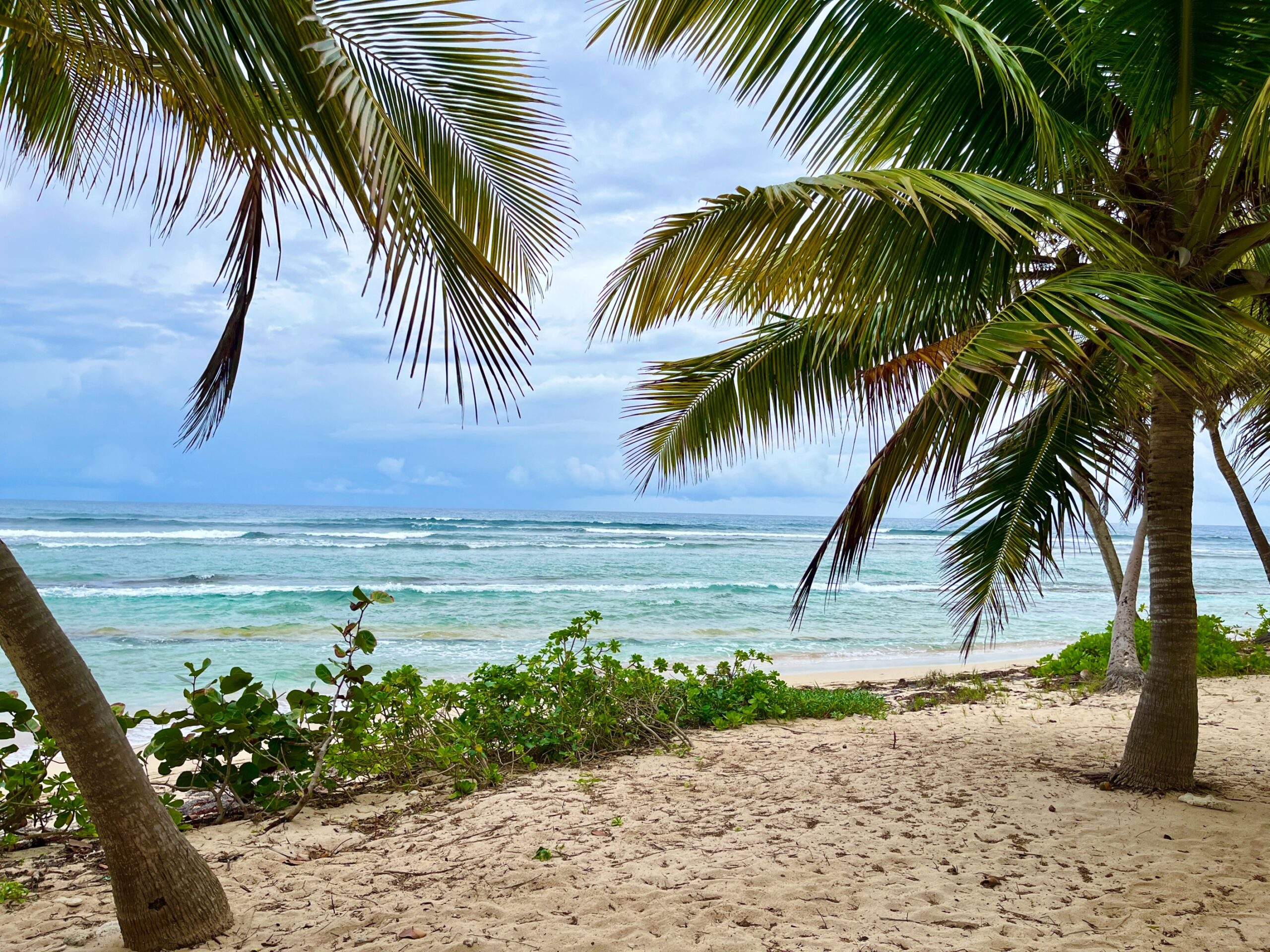
The National Weather Service in San Juan, Puerto Rico, has reported that a northerly swell is spreading across Atlantic waters surrounding Puerto Rico and the U.S. Virgin Islands, creating hazardous marine and beach conditions over the coming days. Marine alerts are in effect across both U.S. territories.
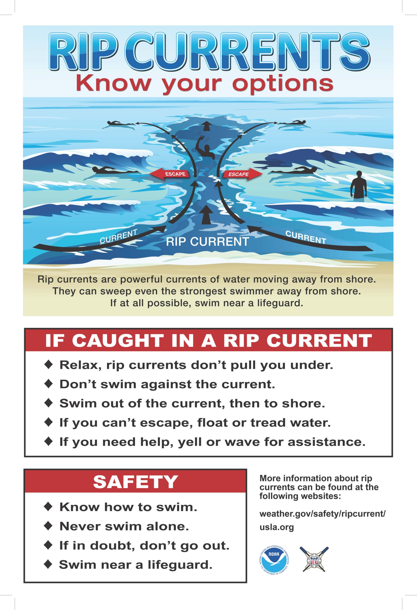
Dangerous Surf and Rip Currents
In an update from the NWS on Thursday, forecasters warned that the energy from the swell will create breaking waves between six and eight feet, building to as high as 10 to 12 feet along exposed northern coastlines. Dangerous surf and life-threatening rip currents will persist, particularly through late Friday. Winds may also become gusty at times, contributing to wind-driven, choppy seas.
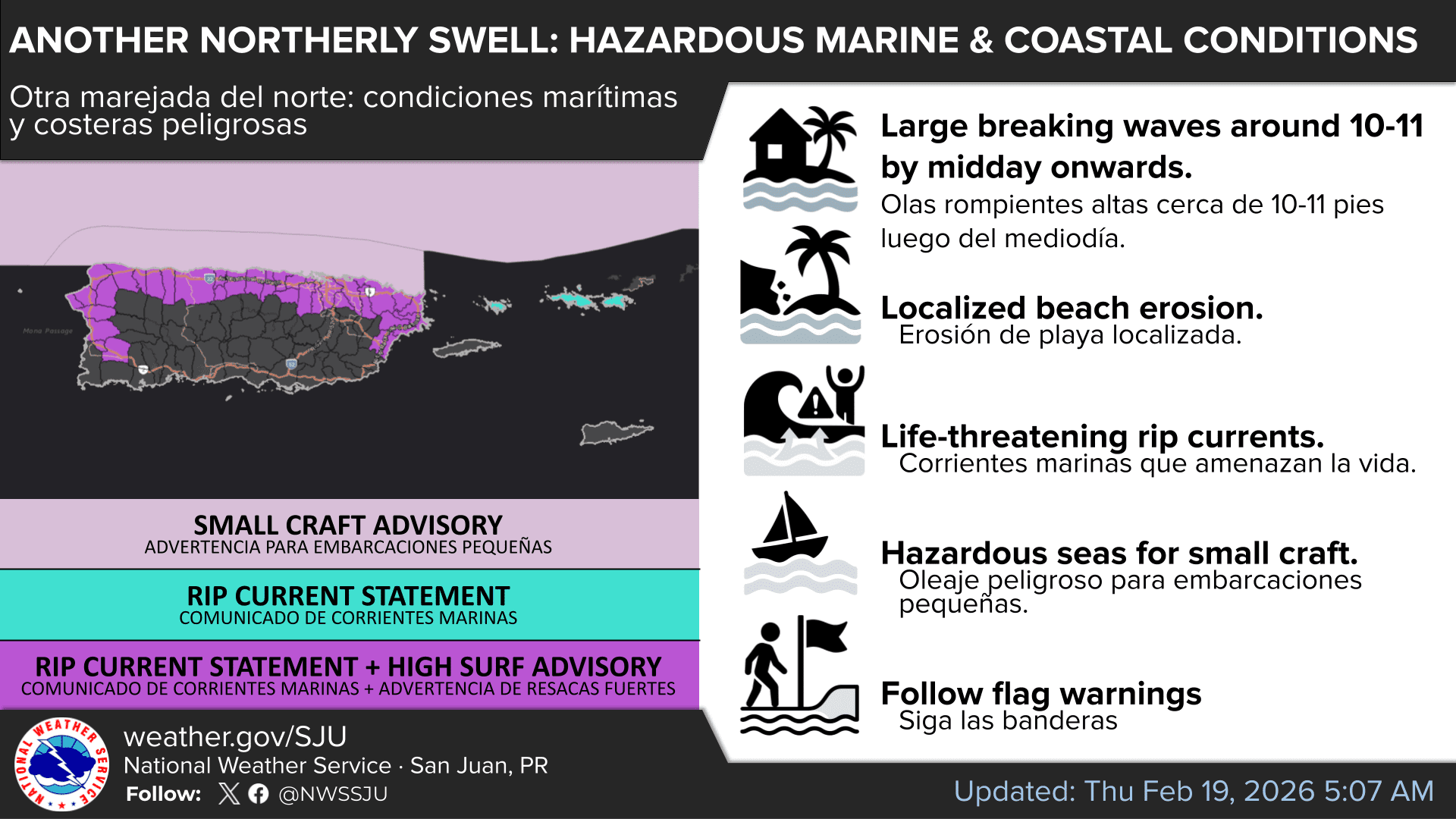
A High Rip Current Risk is in effect for St. Thomas and St. John, as well as portions of Puerto Rico, while Small Craft Advisories are issued for offshore Atlantic waters. A High Surf Advisory has also been announced for parts of Puerto Rico.
“Beach conditions will become more hazardous as a long-period northerly swell continues to spread across the Atlantic waters and local Caribbean passages through Thursday night,” the NWS said. “The latest model guidance indicates that the swell will peak tonight through Friday morning. Therefore, high surf conditions and life-threatening rip currents will continue along the beaches from northwestern to northeastern Puerto Rico, including Culebra, as well as St. Thomas and St. John in the U.S. Virgin Islands,” the NWS continued.
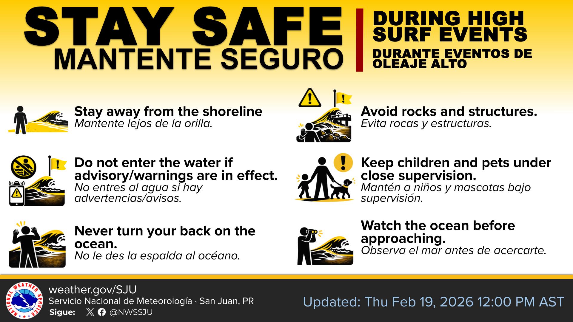
“Beachgoers and inexperienced surfers are urged to stay out of the water, continue monitoring forecast updates, and follow all local advisories, warnings, and guidance from lifeguards and local officials as conditions deteriorate,” the NWS advised.
The NWS noted that the seas are forecast to become calmer late in the weekend, before another swell possibly arrives during the middle of next week.
Detailed rip current safety information is available on the National Oceanic and Atmospheric Administration website.
Mostly Fair Weather Expected Into the Weekend
While marine hazards remain the primary concern, the NWS also said that brief trade wind showers may pass over the local islands at times. However, the flooding risk is expected to remain limited and primarily concentrated across portions of Puerto Rico.
A more stable weather pattern is developing across the region as high pressure strengthens over the area, creating slightly drier and more settled conditions. Through at least Saturday, mostly fair weather with moderate winds is anticipated across the Virgin Islands, with passing showers at times, and temperatures are expected to remain slightly above normal.
Looking ahead to early next week, the NWS said patches of moisture may move across the region beginning Sunday, and a trough of low pressure could help increase shower activity by the middle to latter part of the week.
Where to Find Weather Updates
Severe weather and other natural hazards can occur at any time of year. Information regarding the weather across the USVI, including marine forecasts, is available from the NWS and NOAA.
Additionally, the local forecast is regularly updated on the Source Weather Page, where a weekly video forecast is available.
Residents and visitors can also view weather alerts and disaster preparedness information from the Virgin Islands Territorial Emergency Management Agency.


