
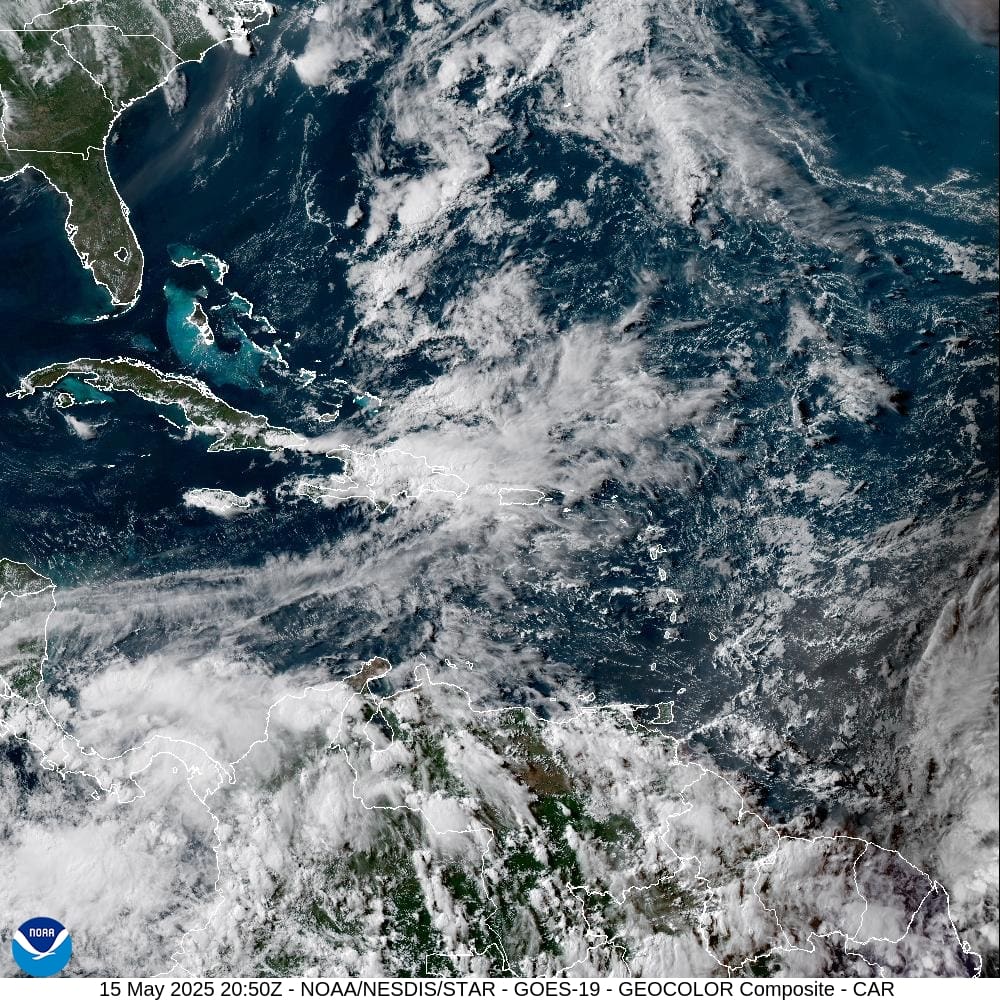
Unsettled weather may bring periods of rain and the possibility of flooding to the U.S. Virgin Islands and Puerto Rico this weekend. The National Weather Service in San Juan explained that conditions will likely be favorable for scattered showers and thunderstorms, with localized flooding due to already saturated soils.
“The local islands once again are expected to experience a wet weather pattern by the end of the workweek and into the weekend,” the NWS explained on Thursday. “This pattern is the result of abundant moisture combined with an upper-level trough moving across the northeast Caribbean,” the NWS said.
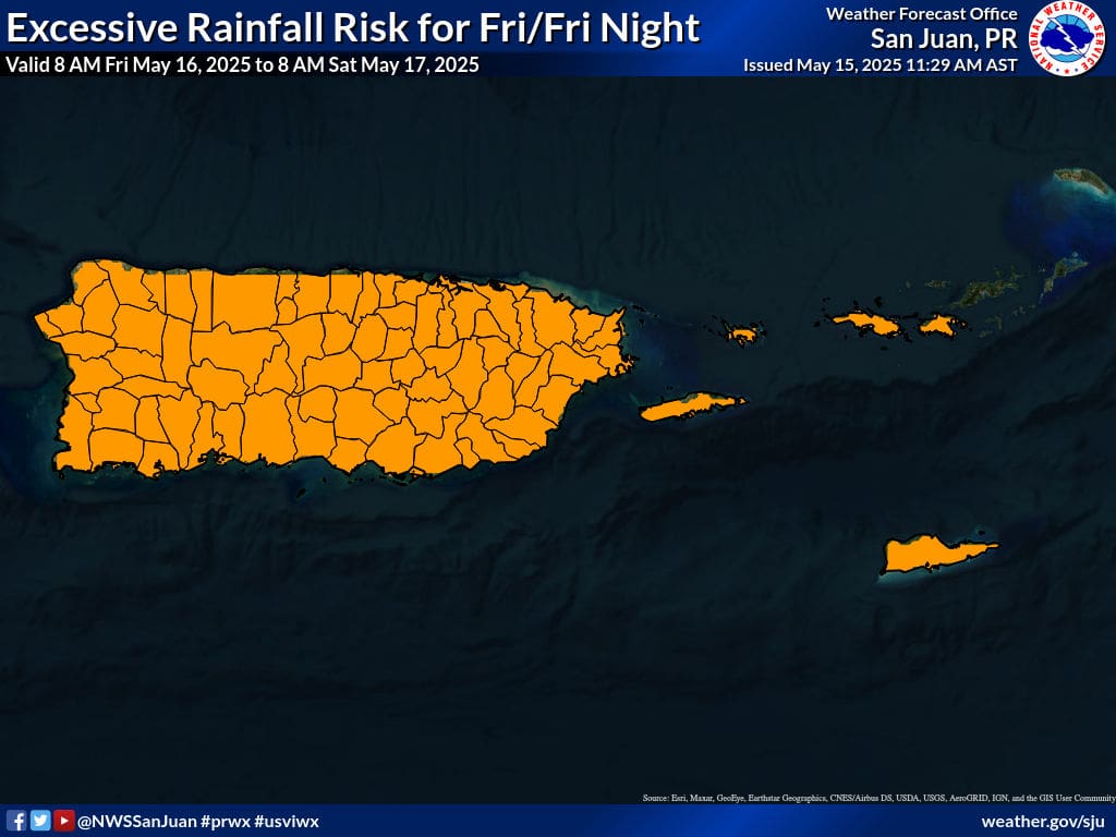
“Based on the latest guidance, the heaviest rainfall is most likely to occur from Friday into Saturday,” the NWS warned.
“The areas expected to receive the highest rainfall totals include the southeastern and eastern portions of Puerto Rico, as well as Vieques, Culebra, and the U.S. Virgin Islands. Across these areas, there is a moderate chance of receiving two to four inches with locally higher amounts of up to six inches each day,” the NWS stated. “Elsewhere, the potential exists for rainfall totals to exceed one to two inches.”
Flooding Possible Across Local Region
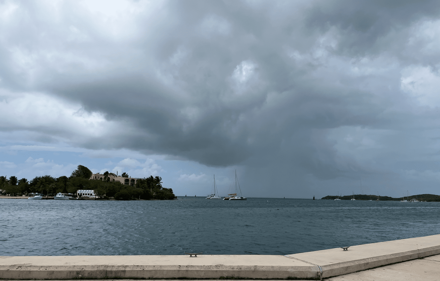
Recent heavy rainfall has eliminated concerns about drought conditions across the islands. However, as the ground already holds significant moisture, additional rainfall could lead to flash flooding or mudslides.
“Due to already saturated soils and rivers and tributaries running well above normal levels, there is an increasing risk for flooding across Puerto Rico and the U.S. Virgin Islands on Friday and Saturday,” the NWS cautioned.
“Any prolonged period of heavy rainfall will result in urban and flash flooding, river flooding and mudslides particularly across central and east Puerto Rico where rainfall has been abundant over the past month,” the NWS report continued.
Prepare for Inclement Weather
The Source contacted Emanuel Rodriguez, a senior service hydrologist and meteorologist at the NWS in San Juan, for additional information. Rodriguez offered the following advice to residents and visitors across the region about the potential for rain, noting that an increase in Saharan dust could help to inhibit some precipitation.
“The best chance of showers and thunderstorms for the Virgin Islands is late Friday into early Saturday, and rainfall accumulations are expected from two to four inches,” Rodriguez said. “However, there is some uncertainty due to the presence of Saharan dust, and this dust may inhibit rainfall somewhat. “We are still leaning toward a wet forecast,” he added.
Rodriguez explained that precipitation can occur during this time of the year, known as the “early wet season.”
“This is the early wet season, and usually by late April and during May, troughs dig into the region, increasing the potential for showers and thunderstorms,” Rodriguez explained. “Then, in June and July, we experience the midsummer drought, a period in which we get a lot of [Saharan] dust, very few troughs or tropical waves, and rain is usually less,” he stated.
Additionally, swimmers and boaters are advised to exercise caution due to the potential for thunderstorms and gusty winds across the local waters. The risk of rip currents is forecast to be moderate across a majority of the region, particularly on Friday.
Where to Locate Forecasts and Alerts
Weather forecast information and severe weather alerts are available from the Virgin Islands Territorial Emergency Management Agency’s website and the National Weather Service.
The Source Weather Page also publishes a daily weather forecast, allowing readers to view weather forecast videos and disaster preparedness video segments.
Finally, residents and visitors across the islands are reminded that the 2025 Atlantic Hurricane Season begins on June 1 and lasts until November 30. The National Hurricane Center has resumed daily Tropical Outlooks, and hurricane season preparedness tips are available on the NHC official website.


