Updated 6/27/24 at 6:13 p.m. AST
Weather updates are posted by Jesse Daley, who has been reporting on weather for the Source since 2022 and holds an Undergraduate Certificate in Weather Forecasting from Pennsylvania State University.
VI SOURCE WEATHER UPDATES
! The NWS has noted that there may be excessive heat and Saharan dust across the islands again on Friday. Excessive Heat Watches, Warnings, or Advisories may be issued. Additionally, the NWS is monitoring several tropical waves for possible cyclonic development. Please see “Tropic Watch” section below.
! An article regarding drought conditions across the territory, as well as details about summer weather, is available here!
! June 1 marked the beginning of the 2024 Atlantic Hurricane Season: NOAA Forecasts Above-Average 2024 Hurricane Season, Expects High Number of Named Cyclones.
Article Series: “Extreme Weather in the Caribbean”
- Part 1: Caribbean Earthquakes and Tsunamis
- Part 2: Caribbean Volcanoes
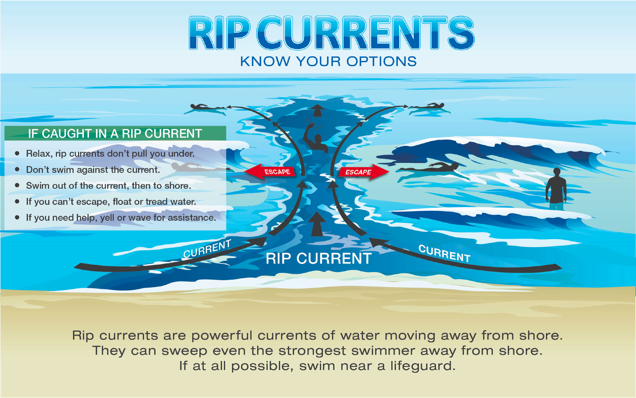
- Part 3: Rip Currents
- Part 4: Hurricanes
- Part 5: Wildfires
- Part 6: Flash Floods
- An article about earthquakes in the Caribbean is available here!
- An informational video about drought conditions in the USVI is available here!
- Article: Colorado State University Predicts Extremely Active 2024 Atlantic Hurricane Season
- Article: La Niña Weather Pattern May Spawn an Active 2024 Atlantic Hurricane Season
FRIDAY’S WEATHER FORECAST: 6/28/24
![]()
Happy Friday!
According to the National Weather Service (NWS) in San Juan, Puerto Rico, Friday will be mostly sunny, with a slight chance of isolated showers. Lingering Saharan dust may continue to be present over the region, which may be unhealthy for vulnerable individuals and cause hazy conditions. The high temperature will be approximately 87°F, 30.5°C, with winds out of the east at about 15 to 17 mph, gusting up to 22 mph. The Heat Index may be high, and staying hydrated and cool is essential. Excessive Heat Warnings or Advisories may be issued. The chance of rain on Friday is roughly 10 percent.
Friday night will be partly cloudy, with a chance of scattered showers. The low temperature will be approximately 80°F, 26.6°C, with winds out of the east at about 17 mph, gusting up to 22 mph. The possibility of rain on Friday night is roughly 40 percent.
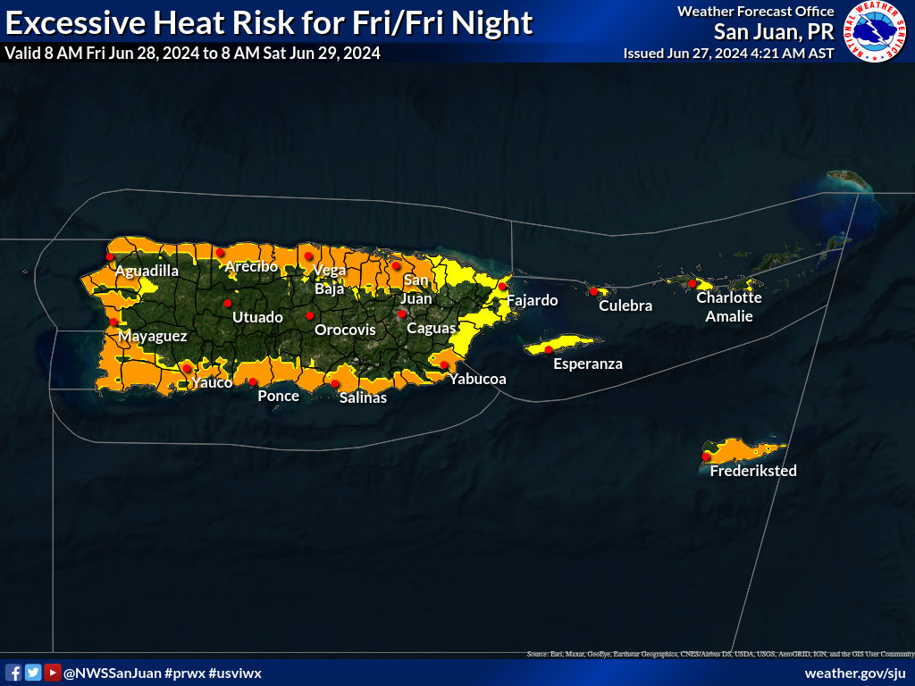
Yellow = Limited Risk, Orange = Moderate Risk, Red = Significant Risk
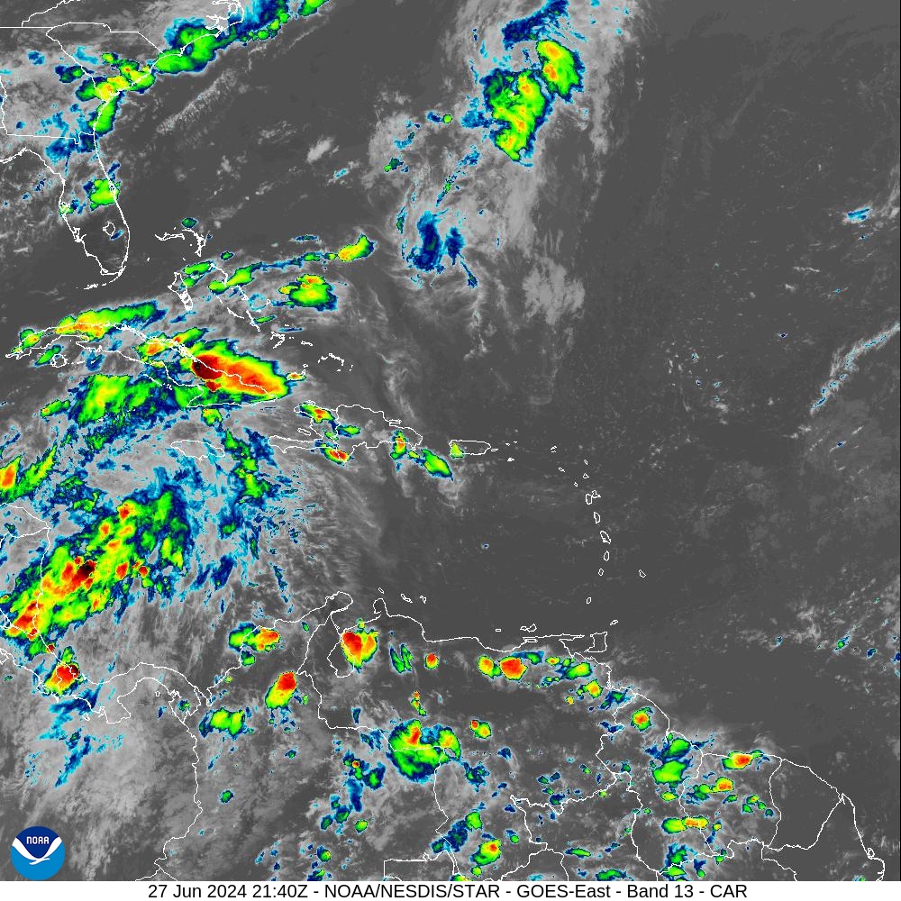
Below: Infrared satellite imagery obtained at 5:40 p.m. AST on Thursday indicates a partly cloudy sky around the USVI and Puerto Rico. Showers are possible.
MARINE WEATHER UPDATE
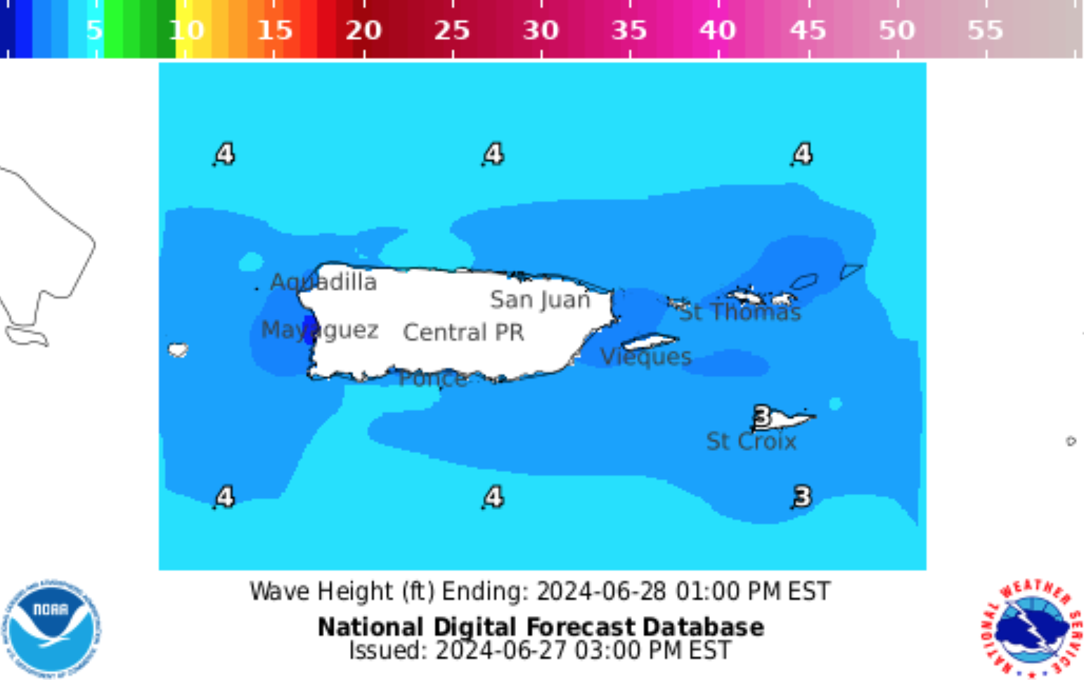
On Friday, the seas will be approximately 2 to 3 feet, with occasional seas up to 4 feet. Winds will be out of the east at about 10 to 15 knots, gusting up to 20 knots.
On Friday night, the seas will be approximately 2 to 3 feet, with occasional seas up to 4 feet. Winds will be out of the east at about 15 knots, gusting up to 20 knots.
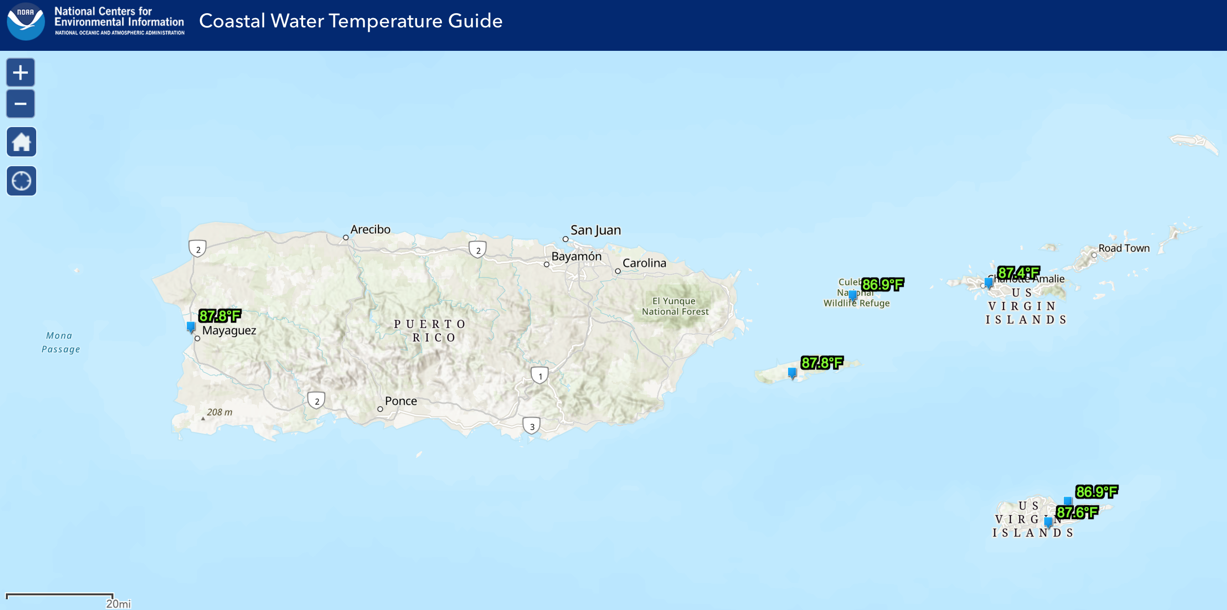
The water temperature is approximately 87°F, approximately 30.5°C.
Ocean Water Temperature Map from 6/25/24, courtesy of NOAA:
Wave Height Forecast Map courtesy of NWS:
HAZARDOUS CONDITIONS
Rip Currents: The risk of rip currents is projected to be low to moderate across most of the region on Friday.
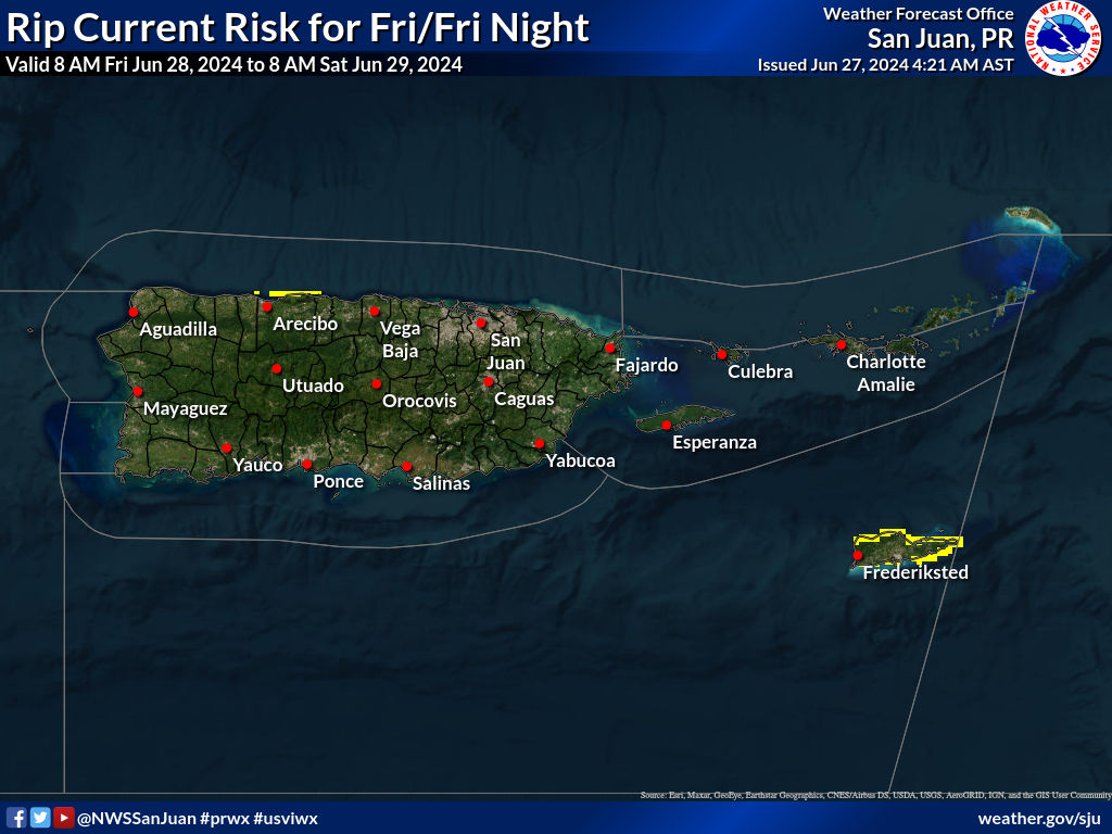
Clear = Low Rip Current Risk, Yellow = Moderate Rip Current Risk, Red = High Rip Current Risk
Learn more about rip current safety in an interview between the NWS and the VI Source here.
TROPIC WATCH
Tropical Activity:
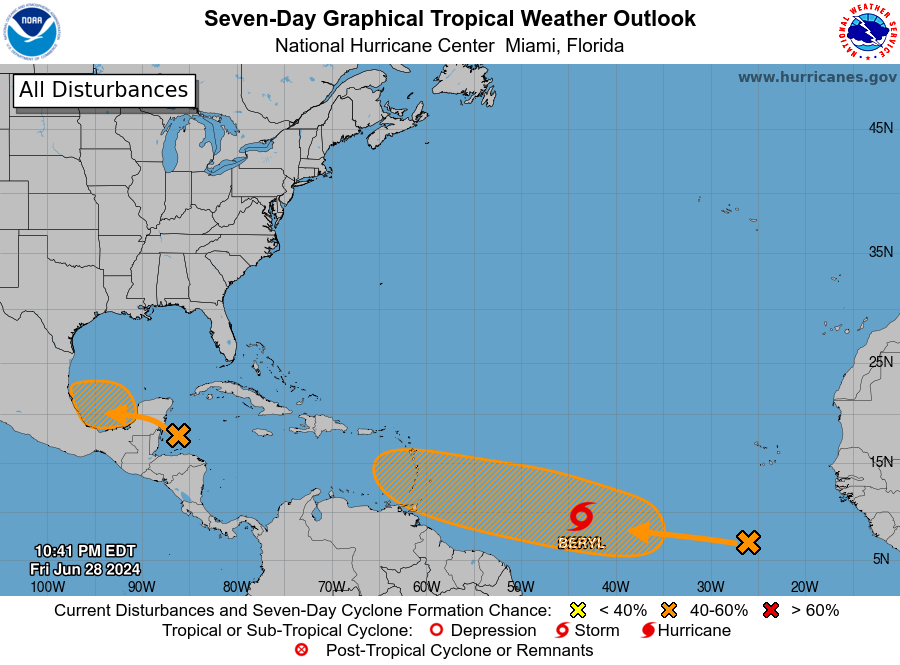
The National Hurricane Center (NHC) is monitoring a tropical wave in the western Caribbean Sea. This system could develop as it moves toward the southwestern Gulf of Mexico later this week. The disturbance currently has a low chance of developing over the next 7 days.
The NHC is watching two tropical waves moving across the Atlantic for possible cyclonic development, which may have some impact on the USVI and Puerto Rico. The first wave, “Invest 95L,” has a high chance of development, and a tropical depression or a tropical storm could form this weekend. Currently, the forecast calls for Invest 95L to pass south of the region early next week, followed by another tropical wave. Regardless, marine conditions will likely deteriorate as the tropical disturbances pass the area. The forecast can change rapidly, and updates will be posted as they become available. Residents and visitors are advised to follow the NHC for updates.
Article: NOAA Forecasts Above-Average 2024 Hurricane Season, Expects High Number of Named Cyclones
Click here to learn tips on being prepared during the 2024 Atlantic Hurricane Season.
Days Remaining in the 2024 Atlantic Hurricane Season: 155 Days
OBSERVATIONS
Sunrise: 5:47 a.m.
Sunset: 7:00 p.m.
Ocean water temperature: Approximately 87°F, approximately 30.5°C.
UV index: 10 out of 10 (VERY HIGH)
Thursday’s high temperature: 90°F, 32.2°C
Thursday’s low temperature: 80°F, 26.6°C
Preparation for extreme weather events in the Caribbean, such as earthquakes and tropical cyclones, is important. Residents and visitors in the USVI are encouraged to stay updated on weather events on the V.I. Source Weather page and sign up for alerts from the National Weather Service and the Virgin Islands Territorial Emergency Management Agency.


