

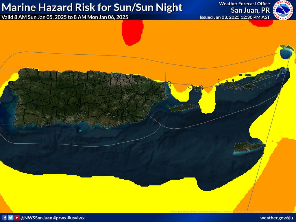
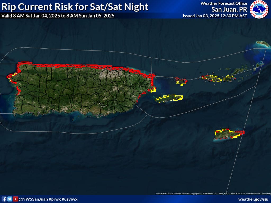
The National Weather Service (NWS) in San Juan, Puerto Rico, has reported that seas around the U.S. Virgin Islands and Puerto Rico will be hazardous for several days. Separately, travelers are encouraged to monitor flights due to a significant winter storm on the U.S. mainland.
Choppy Seas
The NWS explained that gusty winds and approaching swells will deteriorate the marine conditions around the local islands.
“A long-period northeasterly swell will gradually spread across the local waters [on Friday],” according to an update from the NWS on Friday afternoon. “This swell will increase the risk of life-threatening rip currents through the weekend with rough surf conditions along the northern exposed beaches of the islands,” the NWS continued. (A period of a swell refers to the time between breaking waves.)
“[Additionally,] a larger long-period northwesterly swell will arrive on Sunday and linger through early next week, causing large breaking waves that will lead to High Surf Advisory conditions, minor beach erosion, and life-threatening rip currents, particularly along the Atlantic coastline of Puerto Rico from Rincon to Fajardo, and Culebra.,” the NWS said.
“Across the U.S. Virgin Islands, life-threatening rip currents will prevail across all northern exposed beaches due to the long period swells,” the NWS added.
The NWS noted that wave heights could reach upward of 10 feet over the next few days. A High Rip Current Risk will be in effect for portions of Puerto Rico and the USVI from 6 a.m. on Saturday until at least 6 p.m. on Monday. Additional marine alerts may be issued throughout the weekend, and swimmers and boaters are urged to exercise caution.
Regarding rip current safety, the National Oceanic and Atmospheric Administration offers the following tips. (Additional advice on rip current safety is available on NOAA’s website here.)
“If caught in a rip current … know your options:
- Relax; rip currents don’t pull you under.
- Don’t swim against the current.
- You may be able to escape by swimming out of the current in a direction following the shoreline or toward breaking waves, then at an angle toward the beach.
- You may be able to escape by floating or treading water if the current circulates back toward shore.
- If you feel you will be unable to reach shore, draw attention to yourself. If you need help, yell and wave for assistance.”
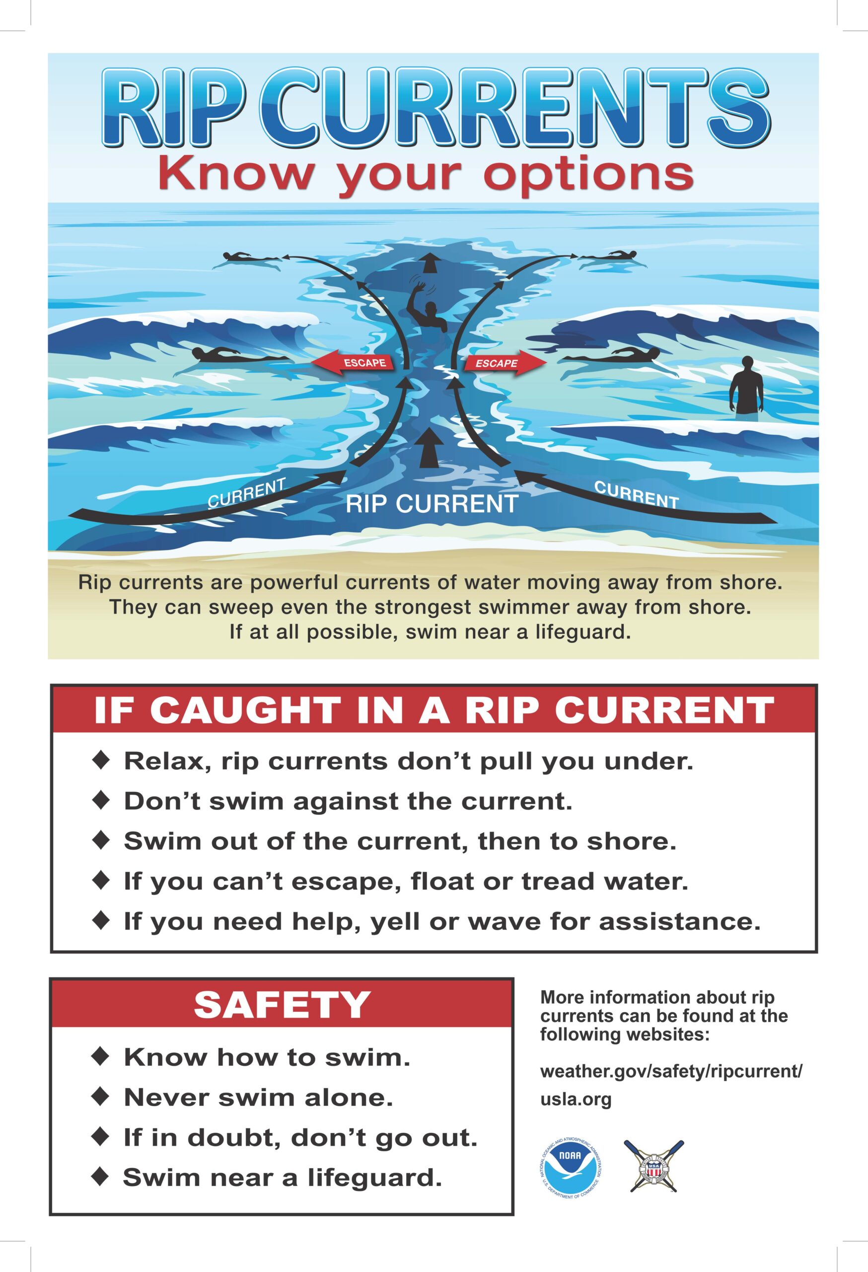
Rip current safety tips and information. (Photo courtesy NOAA and NWS)
Pleasant Weather for Local Islands; Wintry Weather Across the U.S. Mainland
Across the USVI and Puerto Rico, intermittent rainfall, thunderstorms, and gusty winds are forecast for this weekend. Still, the NWS has noted that pleasant tropical winter weather can be expected over the coming days for the local islands, particularly from Sunday night onward, with comfortable temperatures, partly cloudy skies, cooling breezes which may be strong at times, and a slight chance of a passing shower.
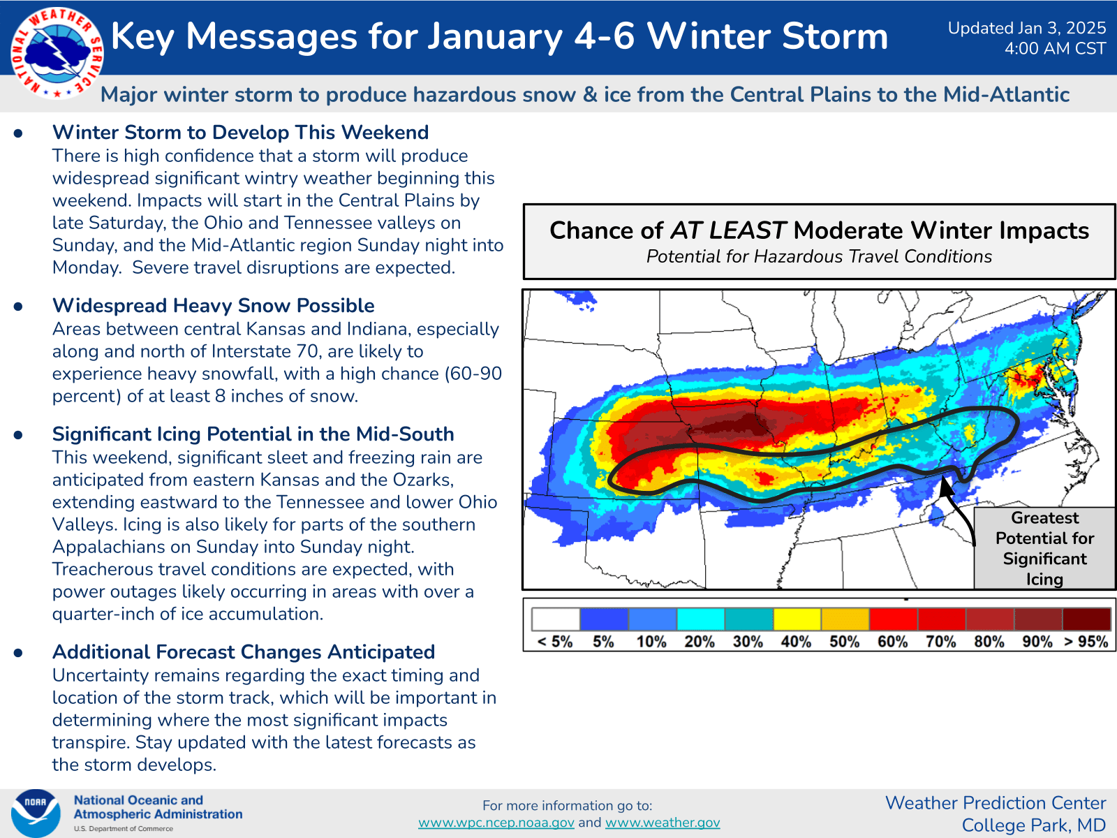
However, the weather situation is drastically different on the U.S. mainland this weekend and early next week. A significant winter storm will affect a large swath of the country from the midwestern states to the east coast. Rain, snow, sleet, ice, and frigid temperatures are anticipated, and air travel to and from the U.S. Virgin Islands may be affected.
“There is high confidence that a storm will produce widespread significant wintry weather beginning this weekend [on the U.S. mainland],” according to the Weather Prediction Center (WPC), part of the NWS. “Impacts will start in the Central Plains by late Saturday, the Ohio and Tennessee valleys on Sunday, and the mid-Atlantic region Sunday night into Monday,” the WPC said. “Severe travel disruptions are expected,” the WPC added.
Travelers are advised to monitor flights into and out of the USVI due to the potential for delays or cancellations.
Weather Updates
Weather forecast information and severe weather alerts are available from the Virgin Islands Territorial Emergency Management Agency’s website and the National Weather Service.
The Source Weather Page also publishes a daily weather forecast and offers readers the opportunity to view weather forecast videos and disaster preparedness video segments.


