
The U.S. Virgin Islands took part in the annual Caribe Wave tsunami preparedness exercise Thursday, engaging residents and emergency agencies in a simulated tsunami response. The drill aimed to raise awareness of tsunami risks and ensure the community can respond quickly and safely in an emergency.
“Caribe Wave is the annual tsunami exercise of the Intergovernmental Coordination Group for the Tsunami and Other Coastal Hazards Warning System for the Caribbean and Adjacent Regions of the Oceanographic Commission of the United Nations Educational, Scientific, and Cultural Organization,” according to TsunamiZone.com.
Approximately 48 countries and territories are a part of the UNESCO Caribe Early Warning System, including the USVI and Puerto Rico.
“The purpose of this exercise is to validate and advance tsunami preparedness efforts in the Caribbean and Adjacent Regions, [and] the annual Tsunami Regional Exercise, ‘Caribe Wave 2025,’ will take place on March 20, starting at [11 a.m. Atlantic Standard Time],” TsunamiZone said.

A previous Source article explained the plans for what would occur during the exercise:
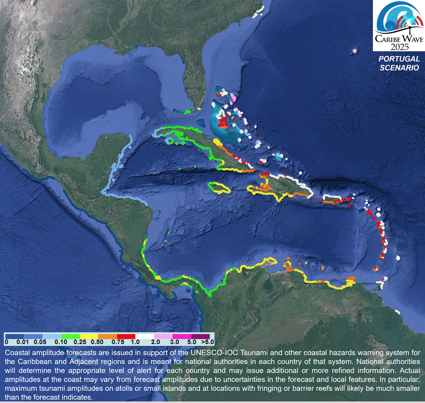
This year, the Caribe Wave exercise will simulate two separate hypothetical scenarios that could generate tsunami waves across the Caribbean region. One event will focus on an earthquake centered near Jamaica, and the other situation will highlight a theoretical quake that strikes near Portugal.
“Two different scenarios will be simulated for Caribe Wave 2025, [and] each participating country [or territory] will select the scenario that best fits their objectives,” TsunamiZone explained. “The first scenario simulates a tsunami generated by a magnitude 8.0 earthquake located along the Enriquillo-Plantain Garden Fault Zone [near Jamaica], and the second scenario [involves] a tsunami generated by a magnitude 8.5 earthquake located approximately 270 kilometers off the Portugal coast,” TsunamiZone continued.
According to information about the exercise, the USVI will participate in the “Portugal Scenario,” which could generate tsunami waves between one and three meters (three to nine feet) across Caribbean islands.
“The [Portugal Scenario] exercise is based on a hypothetical tsunami scenario similar to ‘The Great Lisbon Earthquake’ that occurred on November 1, 1755,” according to information from UNESCO. “During [that] event, a major earthquake [estimated at having a magnitude between 8.6 and 9.0 occurred] in Lisbon, Portugal, [and] generated a transoceanic tsunami that reached the European and African coasts, islands in the Atlantic, and the Caribbean islands,” UNESCO stated.
“Tsunami messages for this exercise [will be] issued by the Pacific Tsunami Warning Center and the Central American Tsunami Advisory Center based on hypothetical tsunamis,” according to information from UNESCO. “Expected impacts for these events are determined from precomputed tsunami forecast models,” UNESCO said.
Caribe Wave coincided with a monthly test of the network of tsunami sirens across the USVI. (The sirens are tested on the third Thursday of every month on St. Croix, St. Thomas, and St. John.)
VITEMA’s Participation in Caribe Wave Exercise
The Virgin Islands Territorial Emergency Management Agency participated in the Caribe Wave event in several ways, including by conducting mock radio broadcasts between the media and Daryl Jaschen, director of VITEMA, as well as with representatives from the USVI Business Emergency Operations Center, to share information about the hypothetical tsunami and what residents and visitors should do to stay safe. The mock radio interviews provided information about tsunami evacuation areas and assembly areas where residents and visitors could go for shelter. VITEMA will use the simulated radio broadcasts to help improve efficiency and communications between government agencies and private companies to prepare for future real-world emergencies.

Jaschen explained that at 11 a.m. Thursday, individuals located at the VITEMA office in Christiansted, St. Croix, along with individuals in the vicinity, walked a short distance up the hill during the exercise to reach an elevation of 82 feet, considered a safe elevation from tsunami waves. Jaschen noted that approximately 50 individuals congregated at the elevation during the drill. Additionally, Jaschen noted that educational outreach was also provided to schools across the USVI in the weeks leading up to the Caribe Wave.
According to information from TsunamiZone, as of 2:30 p.m. Atlantic Standard Time Thursday, 18,144 individuals throughout the USVI region had registered to participate in the event.
Tsunami Notifications and Their Meanings
In the event of an actual emergency during which tsunami notifications are issued, the National Weather Service offers the following information about tsunami alerts and how to interpret them:
“Tsunami Warning: Take Action—Danger! A tsunami that may cause widespread flooding is expected or occurring. Dangerous coastal flooding and powerful currents are possible and may continue for hours or days after initial arrival. Follow instructions from local officials. Evacuation is recommended. Move to high ground or inland (away from the water).
“Tsunami Advisory: Take Action—A tsunami with potential for strong currents or waves dangerous to those in or very near the water is expected or occurring. There may be flooding of beach and harbor areas. Stay out of the water and away from beaches and waterways. Follow instructions from local officials.
“Tsunami Watch: Be Prepared—A distant earthquake has occurred. A tsunami is possible. Stay tuned for more information. Be prepared to take action if necessary.
“Tsunami Information Statement: Relax—An earthquake has occurred, but there is no threat, or it was very far away, and the threat has not been determined. In most cases, there is no threat of a destructive tsunami.”

Staying Informed and Prepared for Disasters
Caribe Wave serves as a reminder that weather-related disasters, including earthquakes and tsunamis, can strike at any time. While the Caribbean is vulnerable to severe weather during hurricane season, which spans from June 1 to Nov. 30, significant climate events can also occur outside of this period, including hazardous marine weather conditions.
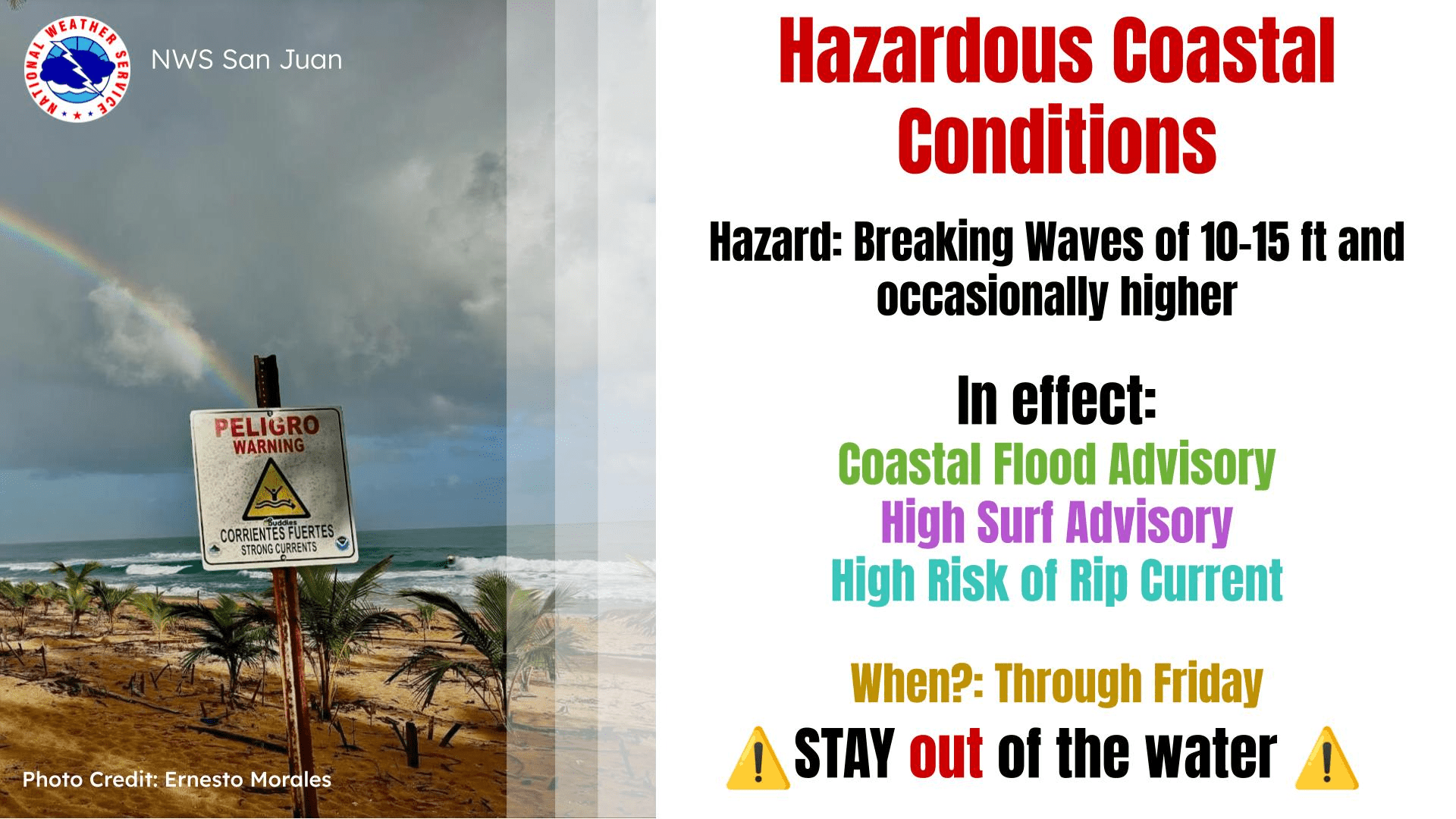
Indeed, on Thursday, the NWS issued several marine weather alerts due to a powerful northwesterly swell, which is expected to impact the local islands for several days. Powerful rip currents and possible coasting flooding are examples of threats that can occur during swell events.
Additionally, on Monday, March 17, the National Hurricane Center highlighted an area of interest in the Atlantic Ocean. The nontropical system, located north of the local islands, has since dissipated. However, individuals across the islands are encouraged to remain vigilant and prepared for any future emergencies. (The NHC will begin issuing daily tropical updates on May 15 and throughout hurricane season.)
Weather Forecast Details
Weather forecast information and marine weather updates are posted regularly on the Source Weather Page, the Source YouTube Channel, and on the official website of the National Weather Service in San Juan, Puerto Rico. USVI residents and visitors can also sign up for emergency alerts, including earthquake and tsunami notifications, from VITEMA.


