

El Niño is often discussed for its influence on hurricane season, but the climate pattern can also affect rainfall, drought, tropical waves, vegetation, and fire weather conditions across the Caribbean, including Puerto Rico and the U.S. Virgin Islands.
What Is El Niño?
According to the National Oceanic and Atmospheric Administration, “Scientists call the two opposing climate patterns of El Niño and La Niña the ‛El Niño-Southern Oscillation’ (ENSO) cycle. El Niño and La Niña can both have global impacts on weather, wildfires, ecosystems, and economies.” ENSO-neutral conditions can occur between phases of a La Niña or an El Niño event.
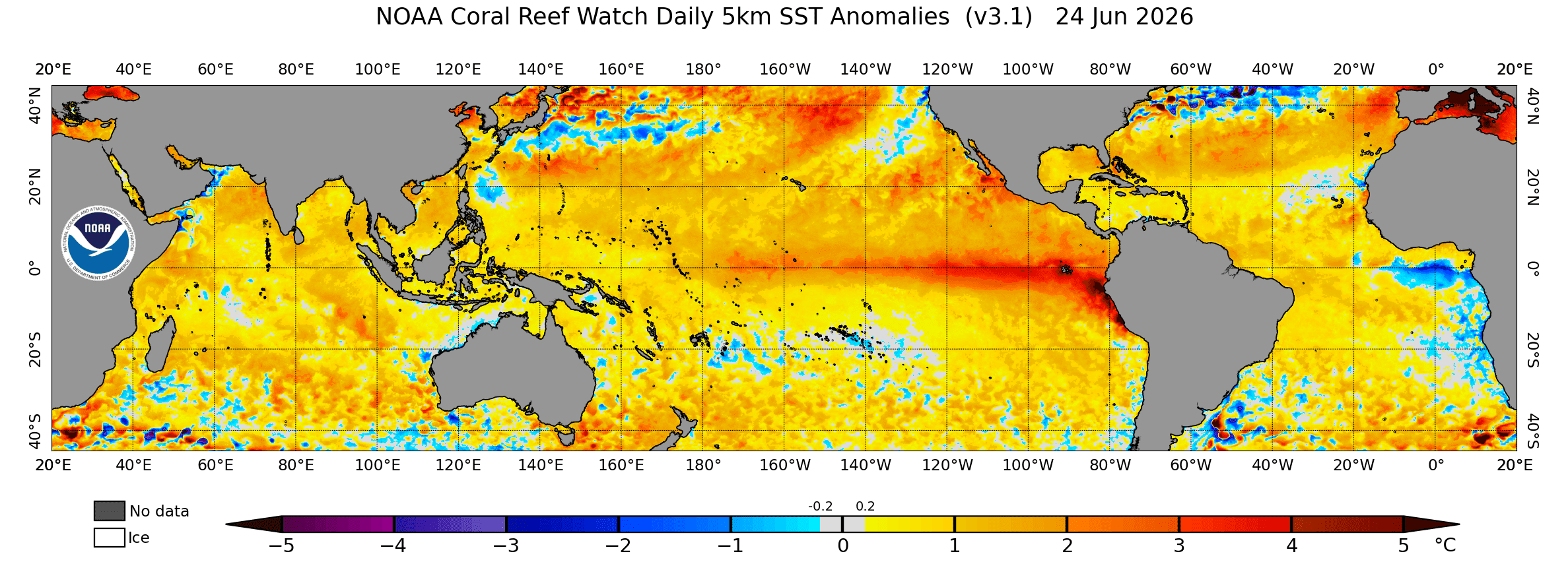
El Niño is the warm phase of ENSO, when sea surface temperatures across parts of the central and eastern equatorial Pacific become warmer than average, and atmospheric patterns can shift across the tropics. Those shifts can influence weather far away from the Pacific, including across the Caribbean.

NOAA’s Climate Prediction Center update on June 11, 2026, stated that El Niño conditions are present and are expected to strengthen into the Northern Hemisphere winter of 2026-2027. The agency also noted that there is a 63% chance of a very strong El Niño during the November to January period.
That does not mean every location will experience the same impacts. However, a stronger El Niño can increase the odds of certain weather and climate patterns developing.
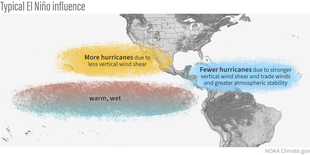
During hurricane season, El Niño is best known for increasing wind shear across portions of the Atlantic Basin. Wind shear refers to changes in wind speed or direction with height in the atmosphere, and too much wind shear can disrupt developing tropical systems by tilting or tearing apart their thunderstorm activity.
However, El Niño’s influence is not limited to tropical storm development. With assistance from NOAA, the Source connected with several experts to learn more about how El Niño can influence weather and climate patterns across the region beyond its better-known role in suppressing Atlantic hurricane activity.
El Niño and Caribbean Rainfall
Across the Caribbean, including Puerto Rico and the U.S. Virgin Islands, El Niño can increase the chances of drier-than-normal conditions during portions of the summer and fall.
Jon Gottschalck, chief of the Operational Prediction Branch at NOAA’s Climate Prediction Center, told the Source that El Niño can influence rainfall in multiple ways, especially around mid-to-late summer.
“El Nino events during the July-August-September season tilt the odds to drier-than-normal conditions,” Gottschalck said. “This results for two primary reasons. The first reason is an eastward shift in the large-scale circulation across the tropics which produces greater-than-normal subsidence, or sinking air in other words, and drier overall conditions. The second reason is the potential for below-normal rainfall due to favored lower numbers of tropical cyclones on account of the inhibiting factors present during El Niño, including higher wind shear, for example,” he explained.
As Gottschalck noted, subsidence can make it harder for clouds and thunderstorms to grow. In practical terms, that can mean less precipitation, weaker tropical waves, or shorter-lived rainfall events.
Drought and Fire Weather Concerns
Seasonal rainfall can be highly variable across the U.S. Virgin Islands and Puerto Rico, where cistern levels, vegetation health, agriculture, and fire risk can all be affected by extended dry spells.
When asked about El Niño’s effects on dry conditions, Gottschalck said drought development can be one of the primary concerns for the Caribbean during El Niño events.
“Drought is often the primary threat or concern in this region during El Niño events,” Gottschalck stated. “There are other factors that can counteract drought development, but on the seasonal time scale, such as the summer season and in hurricane season, dry conditions are the dominant factor. Odds for drought development and fire weather conditions substantially increase during El Niño events.”
Fire weather conditions can become a concern when dry vegetation, warm temperatures, low humidity, and breezy conditions occur together. As the Source previously reported, a territory-wide burn ban is currently in effect.
When the Caribbean Is Most Vulnerable
The timing of El Niño’s influence is important. Its impacts can vary depending on the season, and its effects are not always the same from one event to another.
Michelle L’Heureux, a physical scientist at NOAA’s Climate Prediction Center, also said that the Caribbean region is more vulnerable to drier-than-average conditions during a broad stretch of the warm season.
“Historically, roughly in the June-October timeframe, El Niño can favor drier-than-average conditions across the Caribbean,” L’Heureux noted.
That period overlaps with the heart of the Atlantic hurricane season, as well as the time of year when tropical waves frequently move across the region. For Puerto Rico and the U.S. Virgin Islands, some tropical waves can bring brief but beneficial rainfall. However, if atmospheric conditions are too dry or wind shear is too strong, those waves may pass with limited shower activity.
The Hurricane Connection
Matt Rosencrans, with the Operational Monitoring Branch at the Climate Prediction Center, explained that fewer tropical systems due to El Niño’s influence can sometimes also mean fewer opportunities for significant rainfall.
“With respect to dry conditions, often the lack of hurricanes contributes to a lack of rainfall, but it doesn’t always take an absent tropical event to have below-normal precipitation during an El Niño event,” Rosencrans explained. “ENSO-related lack of precipitation can also be caused by generally lower amounts in smaller precipitation events, such as fewer days with thunderstorms or weaker systems, because the storms can be sheared. Tropical systems are often drought-breaking events, so missed tropical events can extend drought.”
In other words, drought conditions do not only worsen because a major storm misses the region. They can also worsen when smaller rainfall events underperform over time.
Other Factors Also Matter
El Niño is not the only climate or weather factor that can influence rainfall across the Caribbean.
Saharan dust, ocean temperatures, trade-wind patterns, local moisture levels, upper-level wind patterns, and the timing of tropical waves can all play a role.
Gottschalck pointed to how Saharan dust can limit rainfall associated with tropical waves.
“High amounts of Saharan dust tend to result in less wet and energetic tropical waves, and this reinforces the dry signal that often accompanies El Niño,” Gottschalck reported.
Saharan dust is common across the tropical Atlantic and Caribbean during portions of the warm season. It can create hazy skies, reduce air quality, and introduce dry air into the atmosphere. When dust and dry air are widespread, tropical waves may struggle to produce meaningful rainfall.
Still, warm ocean water temperatures can have the opposite effect in some cases by providing additional heat and moisture for showers and thunderstorms when overall atmospheric conditions are supportive.
What Residents Should Understand
For residents and visitors in the U.S. Virgin Islands and Puerto Rico, the status of an El Niño does not promise a lack of cyclones. It is one of several larger climate patterns that can shift the odds over a season.
L’Heureux emphasized that even a strong El Niño does not guarantee a particular outcome everywhere.
“Keep in mind that El Niño is just one factor among many possible weather and climate drivers. This year, because this El Niño is favored to be strong-to-very strong at its peak, the influence of El Niño may be more dominant across the Caribbean. But even a very strong El Niño doesn’t guarantee any outcome; it simply increases the chances of seeing certain outcomes.”
Even during El Niño, tropical storms and hurricanes can still form, if they find a favorable window with lower wind shear, warm ocean water, and enough moisture.
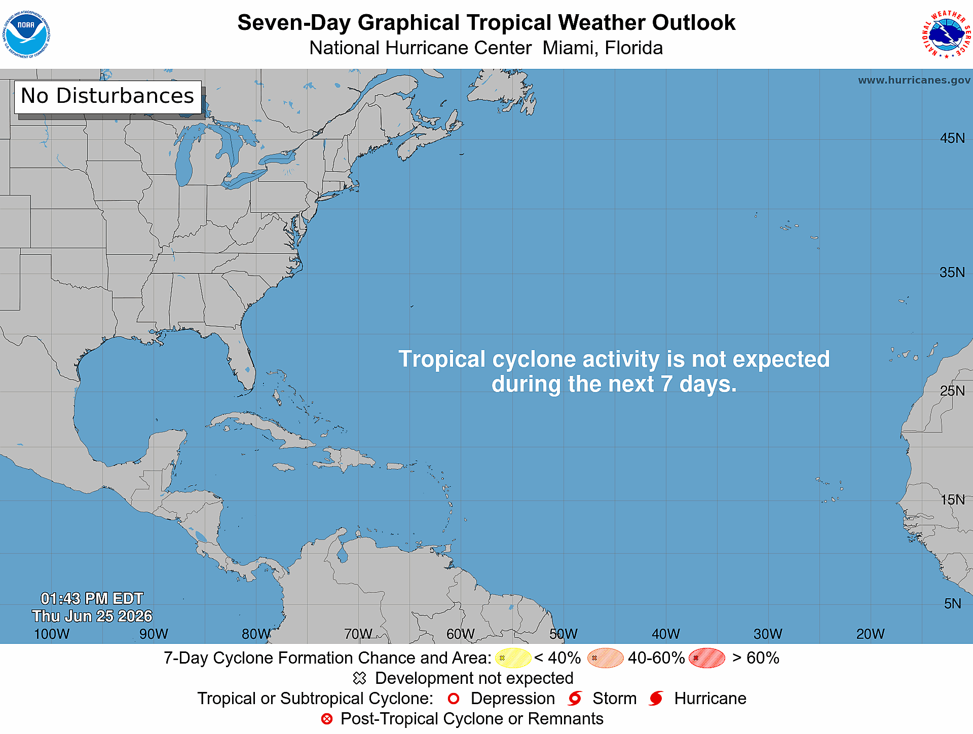
As of Thursday, June 25, one named tropical storm, Arthur, had already formed in the Gulf region. As the Source previously reported, Tropical Storm Arthur developed on June 17, serving as a reminder that storms can still form during El Niño years. For the Caribbean, the main message is that El Niño can influence more than hurricane numbers alone, affecting rainfall patterns, drought risk, fire weather conditions, vegetation, agriculture, and water resources.
Local Weather Updates
Information regarding the weather across the USVI, including marine forecasts, is available from the NWS and NOAA. The latest tropical forecasts can be viewed on the official website of the NHC.
The local forecast is regularly updated on the Source Weather Page, and a weekly video forecast is available. Additionally, residents and visitors can view weather alerts and disaster preparedness information from the Virgin Islands Territorial Emergency Management Agency.


