

The National Hurricane Center continues to monitor a tropical wave approaching the Leeward Islands. On Friday, the system is forecast to pass near the U.S. Virgin Islands and Puerto Rico, bringing the potential for rain, thunderstorms, gusty winds, and choppy seas.
“A tropical wave, Invest 94L, will increase the potential for showers and thunderstorms on Friday and Saturday, elevating the risk of flooding, gusty winds, and lightning,” according to an update from the National Weather Service in San Juan, Puerto Rico. “Marine conditions will deteriorate as well, particularly for the offshore Atlantic waters,” the NWS continued. (An “invest” is an area under investigation for tropical development by the National Weather Service.)
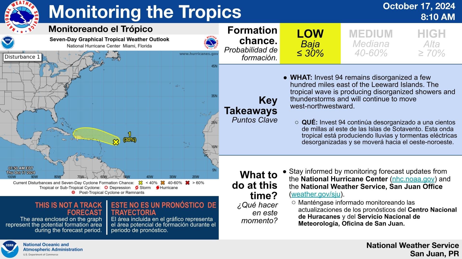
The NHC has been following Invest 94L for several days, and earlier this week, the NHC had given the tropical disturbance a moderate chance of development. However, the system has been moving through an area not conducive for cyclonic development during the last few days, helping to limit its intensification. Still, the NHC has noted that additional organization or intensification is possible as the tropical wave passes close to the local islands.
“A poorly-defined trough of low pressure located a couple of hundred miles east of the Leeward Islands is producing some disorganized showers and thunderstorms,” according to an 8 p.m. update from the NHC on Thursday. “Development, if any, of this disturbance, should be slow to occur while it moves quickly westward to west-northwestward at around 20 mph, passing near the Virgin Islands and Puerto Rico on Friday, then near Hispaniola and the southeastern Bahamas on Saturday,” the NHC explained. “By late this weekend, further development is not expected due to strong upper-level winds,” the NHC added.

Potential Impacts to USVI, Puerto Rico
Regardless of whether Invest 94L experiences further development before passing across the local region, residents and visitors can expect periods of rainfall, possibly heavy at times, as well as thunderstorms with lightning. Flooding is also possible.
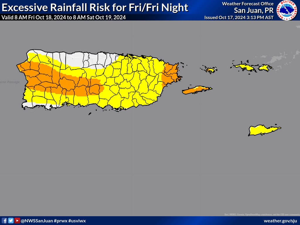
“The increasing moisture and instability will bring an increasing potential for showers and thunderstorms, [and] an elevated risk of flooding, river rises, and mudslides are expected,” the NWS warned.
Additionally, swells generated by the disturbance are forecast to cause choppy seas and an increased risk of rip currents.
Meteorologists at the NWS have noted that the wet weather pattern, along with hazardous seas, could extend through next week. Other weather impacts forecast to affect Puerto Rico and the U.S. Virgin Islands include excessive heat throughout the week. Staying hydrated and cool is essential to help avoid heat-related illnesses.
“A wetter pattern is expected for the islands beginning Friday and stretching into next week. First, moisture associated with Invest 94L will reach the islands on Friday and early Saturday,” the NWS explained. “Then, moisture from the tropics converge over the area, [and] as a result, periods of showers will affect the local islands, increasing the risk of flooding, river raises, and mudslides [through next week],” the NWS continued.
Remain Prepared During Hurricane Season
The 2024 Atlantic Hurricane Season has been record-breaking, including the recent and explosive development of Hurricane Milton in the Gulf of Mexico at the beginning of October, the extremely high storm surge associated with Hurricane Helene across the southeastern USA in September, and destructive Hurricane Beryl, which rapidly intensified into a major hurricane and brought devastating impacts to portions of the Caribbean in July.
With more than a month remaining until the official end of hurricane season on November 30, USVI residents and visitors are reminded to stay prepared. The weather forecast can change quickly, and it is essential to stay up to date with forecasts from the NHC. Hurricane preparedness tips are available from the Virgin Islands Territorial Emergency Management Agency and the National Oceanic and Atmospheric Administration.
Weather Updates
Weather forecast information, including severe weather alerts, is available from the VITEMA website and the National Weather Service.
The Source Weather Page also publishes a daily weather forecast and offers individuals the opportunity to view weather forecast videos and disaster preparedness video segments.


