
The National Hurricane Center is monitoring a tropical wave in the Atlantic Ocean called “Invest 94L.” The disturbance is forecast to intensify, and a tropical depression may form next week.
“Environmental conditions are expected to become more conducive for development by the end of the weekend while the disturbance begins to move westward across the central tropical Atlantic,” according to an update from the NHC on Friday.
“Additional development is expected after that, and a tropical depression is likely to form during the early to middle portion of next week as the system moves steadily westward across the central and western tropical Atlantic,” the update continues.
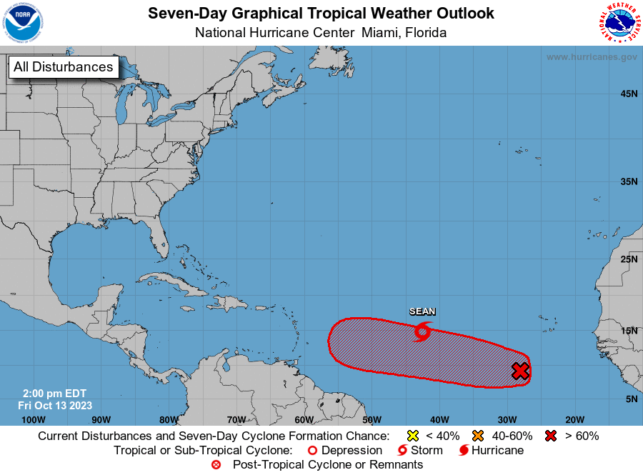
If this system intensifies into a tropical storm, with maximum sustained winds of at least 39 mph, it will be named “Tammy.” In addition to Invest 94L, the NHC continues to watch “Tropical Storm Sean.” At this time, Sean is not expected to threaten land.
2023 Atlantic Hurricane Season
The busy 2023 Atlantic Hurricane season officially ends on November 30, and with approximately a month and a half remaining in the season, it is essential to be vigilant.
A recent update from the National Oceanic and Atmospheric Administration (NOAA) explains that an “El Niño” weather pattern is occurring (El Niño involves an unusual warming of the central and eastern equatorial Pacific Ocean, affecting global weather).
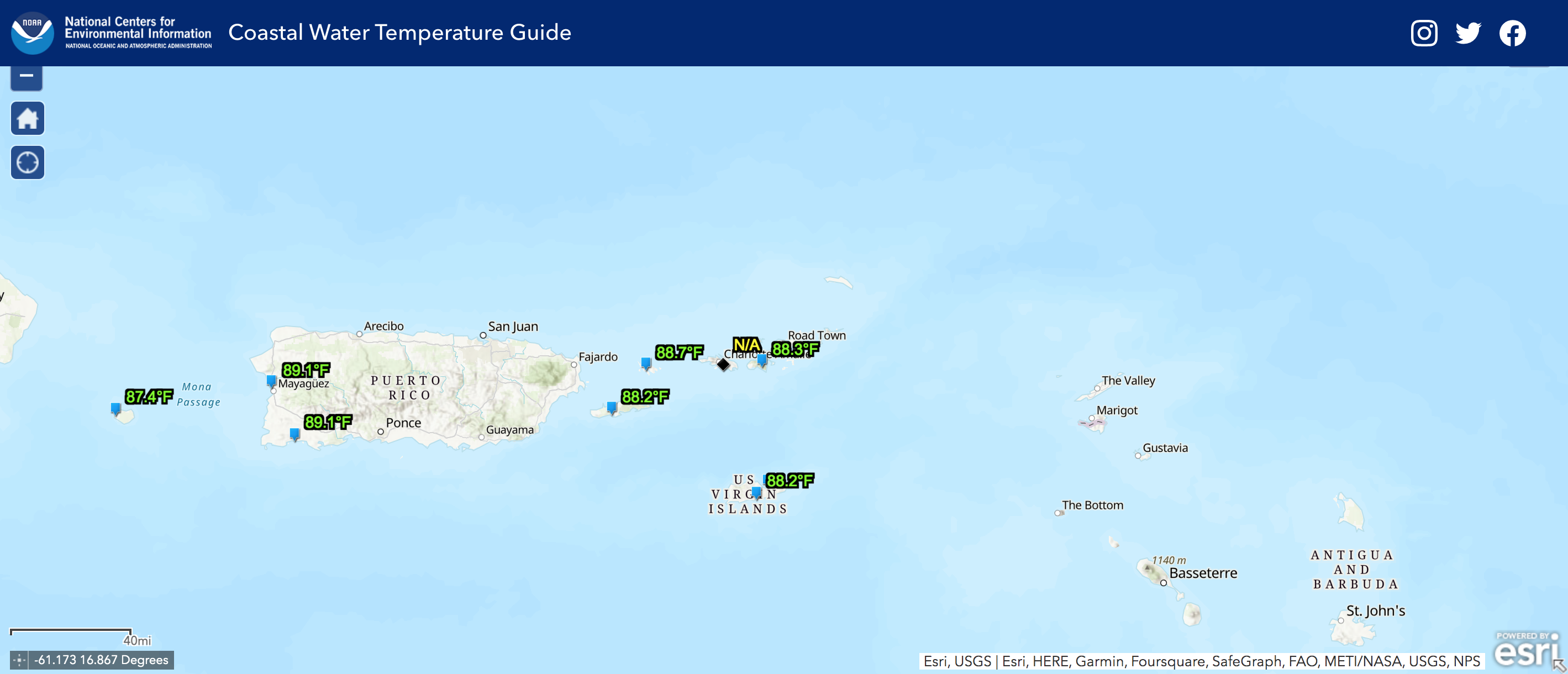
Historically, El Niño can help to suppress tropical activity in the Atlantic and the Caribbean. However, the ocean water temperatures across the region have been extremely warm, which can help cyclones strengthen. On Friday, a NOAA map indicated that the water temperature around the USVI was approximately 88 degrees Fahrenheit.
Stay Informed
Weather updates will be published on the Source Weather Page. Additionally, USVI visitors and residents are encouraged to follow the National Hurricane Center for the latest weather alerts. Information about severe weather, including emergency shelters and alerts, is also available from the Virgin Islands Territorial Emergency Management Agency and the National Weather Service.
A list from the National Weather Service regarding hurricane preparedness is available here.


