

Outside of hurricane season, when USVI residents and visitors enjoy the typically beautiful tropical weather in the islands, meteorologists are working and preparing for the next season. Scientific analysis of previous cyclones can provide critical information and education to improve weather forecasts for the year ahead.
Sim Aberson is a meteorologist at the Atlantic Oceanographic and Meteorological Laboratory’s Hurricane Research Division, part of the National Oceanic and Atmospheric Administration (NOAA). Aberson is a “Hurricane Hunter,” and he is one of the researchers who diligently studies and examines tropical systems and their behavior.

Aberson spoke with the Source and shared details about his work as a NOAA Hurricane Hunter and his analysis of two unique cyclones that formed during the 2023 Atlantic Hurricane Season: Hurricanes Lee and Otis. He has advice for Virgin Islanders ahead of cyclones during the 2024 Atlantic Hurricane Season, which begins on June 1.
NOAA Meteorologist Sim Aberson

Aberson has investigated hurricanes for many years and began his career with NOAA as an intern in 1981. He has been fascinated with tropical weather since he was young.
“Sim Aberson, Ph.D., is a meteorologist at NOAA’s Hurricane Research Division, located at Atlantic Oceanographic and Meteorological Laboratory in Miami, FL,” a NOAA biography explained. “His research has focused on observing systems to give Hurricane Specialists at the National Hurricane Center information to improve their hurricane forecasts,” the biography continued.
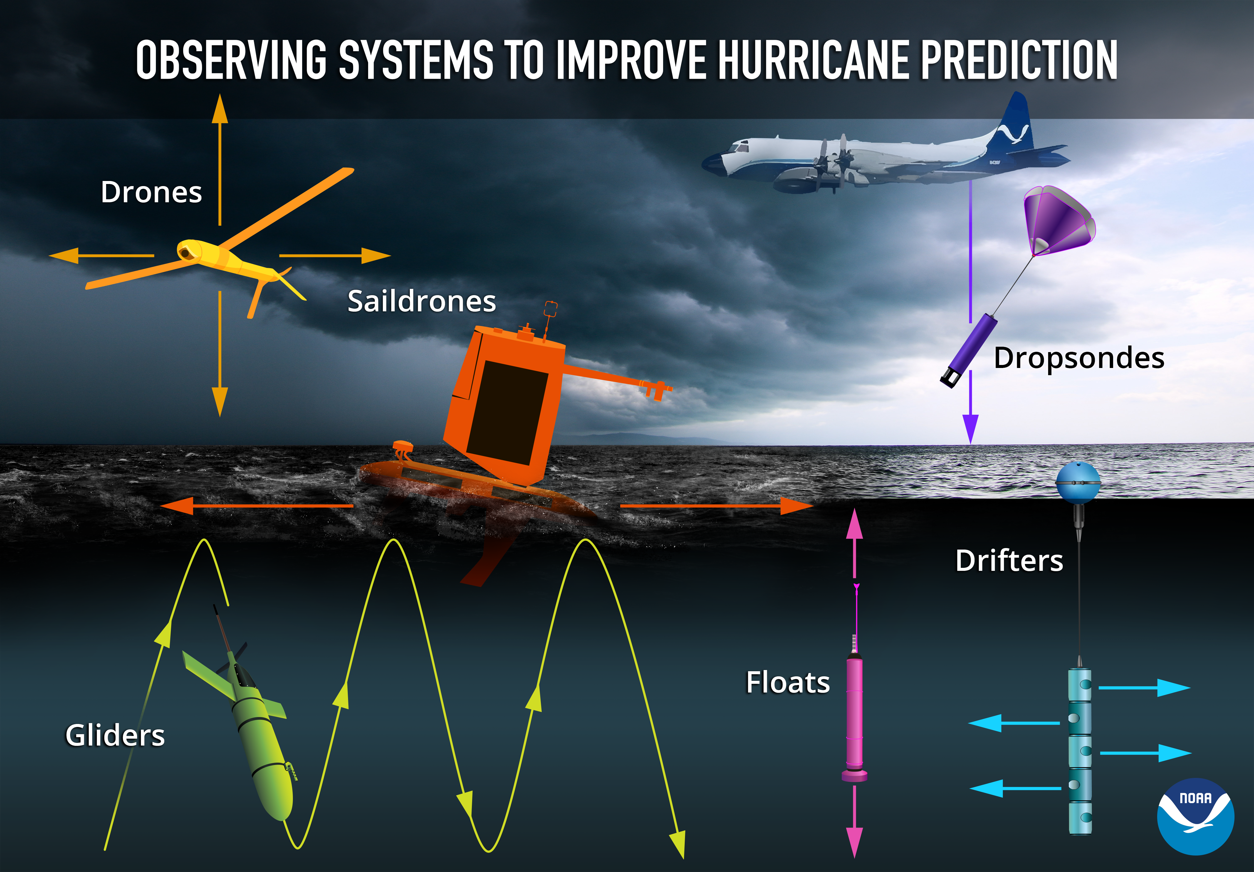
Aberson has been particularly interested in working with “dropwindsondes” on board hurricane hunter flights. According to NOAA, a dropwindsonde “is an instrument deployed from NOAA’s Hurricane Hunter aircraft and drifts down on a parachute measuring pressure, temperature, humidity, and wind as it falls.”
On Board a Hurricane Hunter Flight
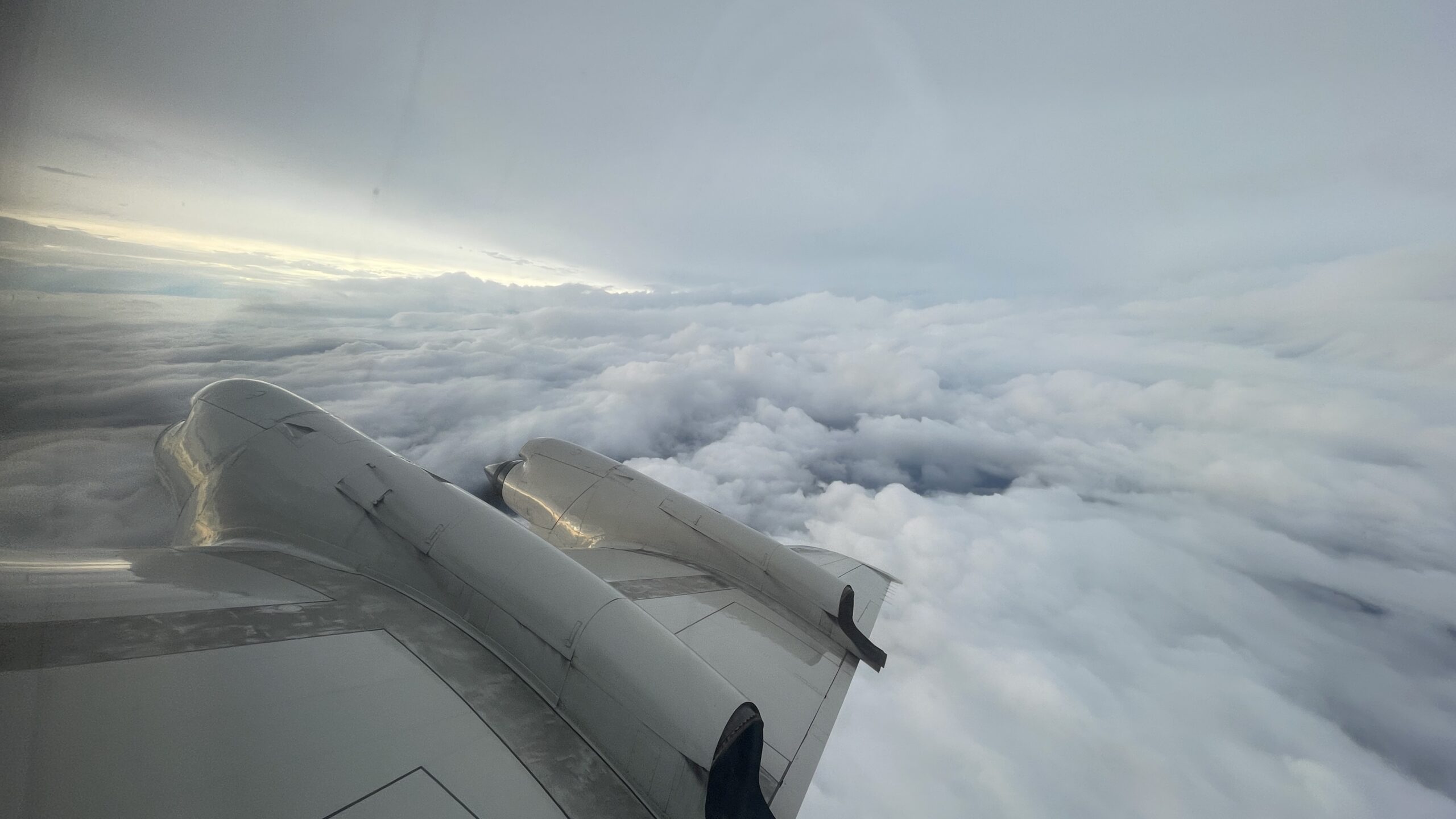
A flight into a cyclone will provide details, including the current location of the hurricane, its maximum windspeed, and the direction and pace at which it is traveling. A team of meteorologists will fly on a unique aircraft across the cyclone and into the storm’s center (the “eye”) to obtain this data. (The area surrounding the cyclone’s center, a region known as the “eyewall,” is typically where the most intense wind speeds are registered.)
A Hurricane Hunter’s responsibilities on a flight into a cyclone range from handling automated weather instruments to working with tools that are not fully automated and require more involvement from a meteorologist (including dropwindsondes).
“The tasks we do on the aircraft have changed over the years as things have been automated,” Aberson explained. “We used to have a lot of people on board just to make sure the data were archived, but we don’t need to do that anymore. One of the main things we do is look — see what is happening, to understand and ask questions. This is how we get our research questions — what is the system doing and why?” he continued. “And, of course, we log these thoughts for later use. As a result, we work with the aircrew to steer the aircraft to sample areas of interest and away from other areas that we deem unsafe.”
“We still do things that involve instruments that are not fully automated,” Aberson noted. “We still need to quality-control dropwindsonde data sent off the plane in real-time. And we also need to manually enter some data to ensure that the Doppler radar data are properly quality-controlled and analyzed before being sent off the plane,” he said.
“When there are research instruments such as new radars, lidars, other remote sensing instruments, or non-crewed vehicles, we also have to tend to those,” Aberson added.
Stationed in the Islands
Caribbean islands, including St. Croix, regularly serve as jumping-off points for scientists to fly toward nearby hurricanes. Aberson is periodically stationed on St. Croix before flying into a cyclone to collect weather data. As The Source reported in 2023, Aberson was in the USVI in September when he was deployed to the island on a mission to investigate Hurricane Lee.
“Since the aircraft have limited range, we move the planes to be close to the storms,” Aberson said. “We do this to maximize the amount of time we can be in the storm given the limitations of the aircraft,” he added.
“Each summer, we work out of St. Croix, Barbados, Aruba, Bermuda, and [other] locations in the U.S. We also sometimes deploy to Liberia, Costa Rica, or places in Mexico if we are looking at East Pacific systems, but that is rarer,” he explained.
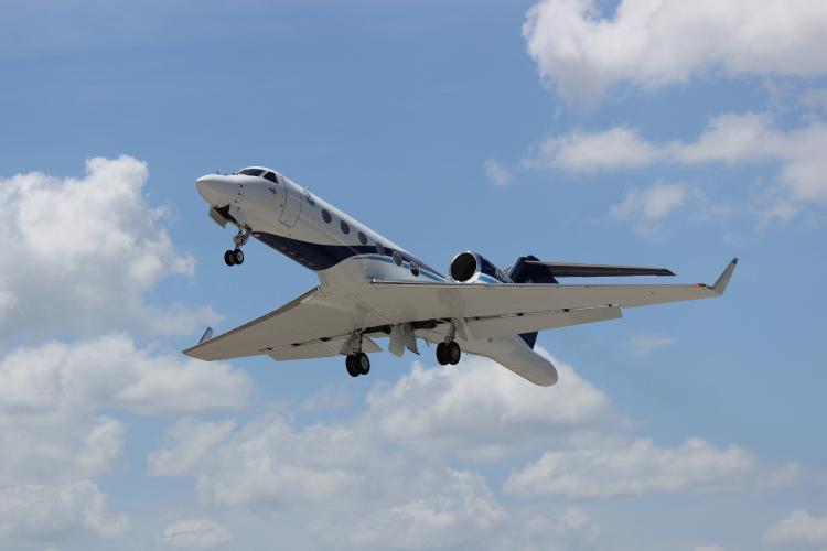
NOAA utilizes exclusive airplanes to fly into a cyclone and collect weather statistics. The highly sophisticated planes are equipped with numerous weather instruments, some of which collect weather information automatically.
“NOAA has three aircraft that they use to fly tropical cyclones: two P-3s and a Gulfstream-IV,” Aberson explained. He noted that the aircraft will be upgraded with newer planes soon. Aberson also mentioned that NOAA aircraft are the research fleet of planes in which certain instruments and techniques are tested before being transitioned to operations. Operations — such as dropwindsondes — are systems and instruments that are proven methods for making forecasts.
The U.S. Air Force utilizes many of these essential operational instruments on its squadron of airplanes. The Air Force employs its own Hurricane Hunters, and their aircraft depart from several islands to begin hurricane reconnaissance missions.
“The Air Force Hurricane Hunters also deploy to St. Croix and Barbados, but not to the other sites. Their aircraft have a longer range than ours,” Aberson noted.
2023 Atlantic Hurricane Season
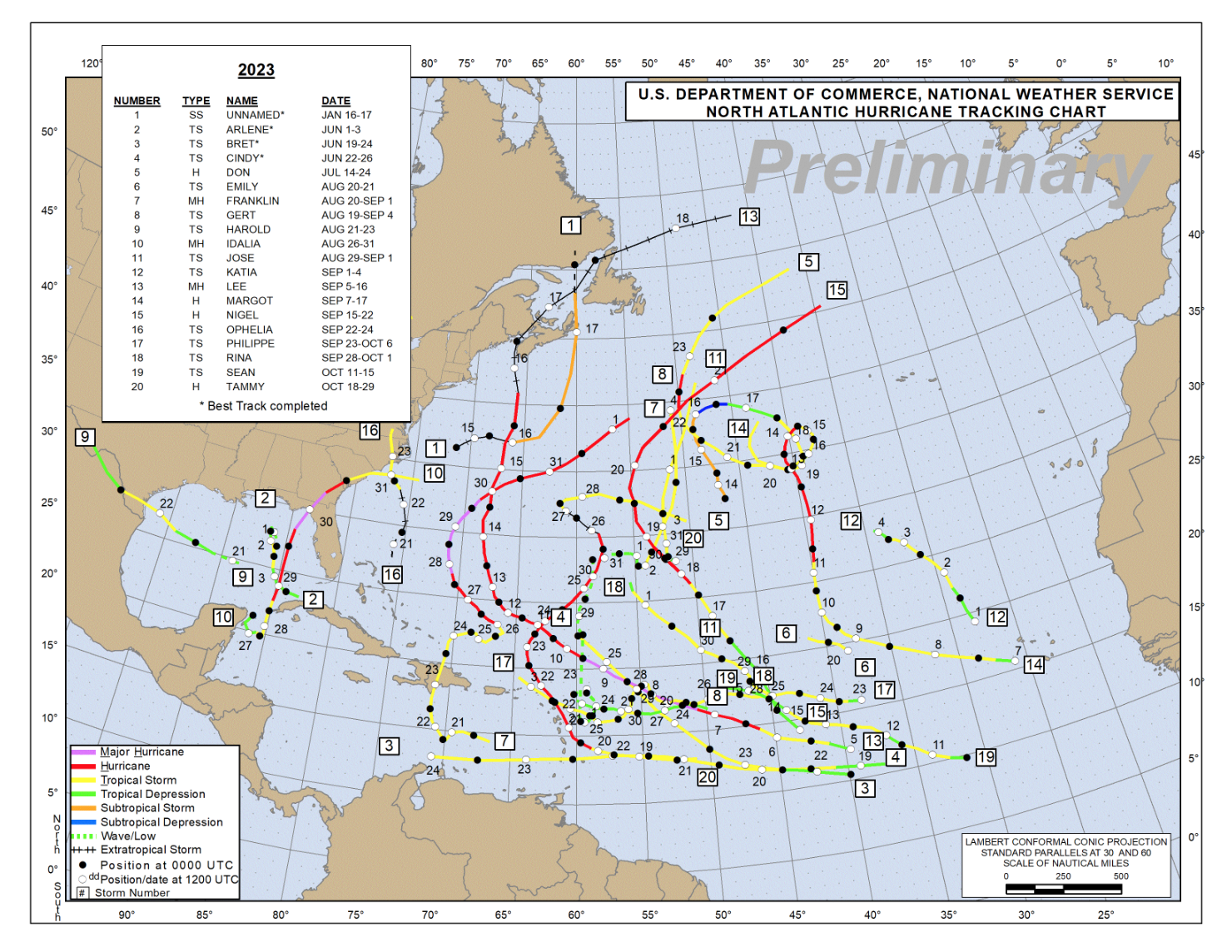
Throughout the busy 2023 Atlantic Hurricane Season, Aberson tracked numerous cyclones to collect data about the mammoth storms, and research is ongoing to learn as much as possible about the hurricanes that formed.
Before last year’s season, forecasts initially called for a potentially less active season, partially due to the beginning of an “El Niño.”
“El Niño is a recurring pattern that involves warming of the ocean across the central and eastern equatorial Pacific. Because the Earth’s weather is driven by the heat in the oceans, it affects weather across the globe, including a typical reduction of tropical activity in the Atlantic and Caribbean due to factors such as increased wind shear across the region,” Aberson explained.
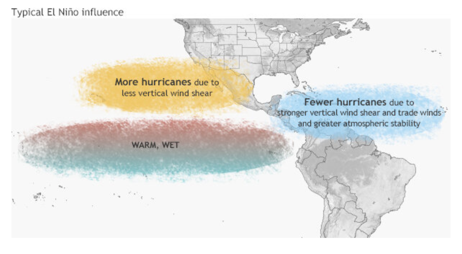
Aberson stated that atmospheric scientists’ initial predictions about the 2023 season were generally correct, including the influence El Niño would have on hurricane development in the Atlantic Basin. However, extraordinarily warm sea surface temperatures across the Atlantic and Caribbean helped to fuel cyclones that managed to develop, and the warm sea temperatures counteracted some of the cyclone-suppressing effects typically seen during El Niño.
Regarding El Niño’s typical effects on climate and suppressing cyclonic development, “the season was similar to what was predicted,” Aberson said. “El Niño lowers activity in the Atlantic, but the very warm sea surface [helped to] increase the [tropical] activity. El Niño also makes having very intense hurricanes south of about 20 N [latitude] very rare, and we saw this season that the intense hurricanes were further north than that. Climatically, the season played out as we expected,” Aberson said.
Aberson noted that even when a hurricane season is forecast to be relatively quiet, cyclones can still develop, and it only takes one major storm to cause catastrophic damage. Residents must be prepared and not let their guard down.
“Seasonal forecasts don’t say much to the people who live in the tropics, since just one devastating hurricane in an extremely inactive year [such as during the Atlantic Hurricane Season of 1992 when Hurricane Andrew impacted Florida] can still occur,” Aberson explained. “Nobody should make plans [simply] based on seasonal forecasts,” he added.
The development and rapid intensification of two tropical systems particularly surprised meteorologists in 2023: Hurricane Otis, which made landfall as a major Category 5 hurricane on the west coast of Mexico, and Hurricane Lee, which also reached Category 5 strength. (Lee brought indirect impacts to locations including the USVI, and it eventually made landfall in Nova Scotia, Canada, after being downgraded.)
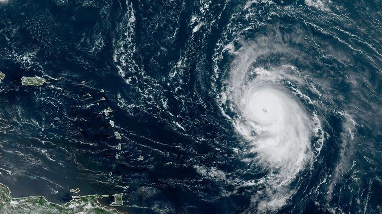
“[Regarding cyclone development,] the two main questions that we have [and will study to find answers] pertain to two very intense hurricanes,” Aberson stated. “Hurricane Lee was an interesting case, as it developed rapidly but never got its core (eye/eyewall) very organized. The eye never became fully upright, and its eye remained so small that Hurricane Hunter aircraft could not safely penetrate it — a rarity! We don’t fully understand why this happened, but we have lots of data to look at,” he explained.
“The other question concerns Hurricane Otis, [which formed] in the East Pacific,” Aberson said. “That storm developed rapidly right before landfall and surprised the people of Acapulco, a large coastal city. None of the [computer] models forecast the possibility that this would happen, whereas the models usually have some basis to show that this could happen. It has been decades since such a big model forecast error, and we must look at the models to understand why this happened. We’re starting to do that now,” he continued.
Motivation to Serve and Protect
The uncertainty that meteorologists and weather forecasters deal with regularly is tremendous. Still, these brave people work tirelessly to learn more about the atmosphere and serve communities by helping to keep residents safe and informed about severe weather.
When Aberson was asked what motivates him most as a meteorologist, he noted that he is dedicated to helping to ensure that individuals are prepared for extreme weather events.
“[The most meaningful aspect of my work as a meteorologist] is being able to help people plan and prepare for the inevitable,” Aberson proclaimed. He is confident that each flight to study a storm is helping to make a positive impact.
“Yes, indeed, each flight is motivating,” Aberson said. “During a flight, we see how the cyclone has evolved from what we saw during the previous [flight] and try to understand how the changes [within the storm] happened. That always brings up a lot of questions that we can go back to the office and investigate,” he added.
Advice for Virgin Islanders and 2024 Hurricane Season
Aberson said it is still too soon to predict what the 2024 Atlantic hurricane season may look like. However, it’s never too early to start planning and preparing for potential tropical systems this year.
Aberson reminded Virgin Islanders that while forecasts constantly improve, they are not perfect. It’s essential to pay close attention to updates regarding any incoming storms.
“The advice for Virgin Islanders is always to be ready to make split-second decisions. Our forecasts are improving each year, but that doesn’t mean that every forecast will be accurate,” Aberson warned. “That’s why we still do research. Be ready for what the forecasters and emergency managers say but note that the storm may be worse in some locations than the forecast says. The Virgin Islands will inevitably have another hurricane, and everyone needs to be prepared,” he concluded.
USVI visitors and residents can read more information about the weather, including any severe weather alerts issued, from the Virgin Islands Territorial Emergency Management Agency website and the National Weather Service.


