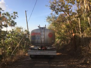
It takes 60 days without rainfall for a region to be declared in a drought, and many areas in the V.I. have gone without rain for longer than that, according to V.I. Agriculture Commissioner Positive Nelson, who said current drought conditions are a growing concern for the department.
The V.I. will officially be added to the U.S. Drought Monitor map on June 6, 2019, said Brad Rippey of the United States Department of Agriculture, who is helping organize the drought monitoring efforts in the V.I.
“This has been a process that began with a multi-agency meeting at the University of the Virgin Islands on St. Croix in August 2016, following the historic drought of the mid-2010s. USVI drought monitoring would have begun sooner but implementation was delayed by the 2017 hurricanes,” Rippey said.
Drought monitoring will begin in June and Rippey said the islands of St. Thomas, St. John and St. Croix will each be mapped separately.
Once the V.I. is added to the map and measurements to determine severity have been done, the department can apply for the Livestock Forage Disaster Program which will supply funding to aid farmers. Per the program’s fact sheet, the LFP is designed, “to provide compensation to eligible livestock producers who have suffered grazing losses for covered livestock on land that is native or improved pastureland with permanent vegetative cover or is planted specifically for grazing.”
The severity of drought on each island will be designated using four categories that range from moderate, severe, extreme and exceptional drought conditions. Categories for abnormal dryness and duration of time without water is also part of the drought monitoring process.
“Rainfall deficits have been particularly acute on St. Croix, but the northern islands have also been drier than normal,” Rippey said.
From Jan. 1 to May 19, 2019, the island of St. Croix had totaled only 5.52 inches of rainfall, which Rippey pointed out is 55 percent of the average. He said the measurements would be a lot lower had the May 1 flash flooding on St. Croix not surged 3.7 inches of water, which “provided little overall drought relief due to rapid runoff.”
On St. Thomas, rainfall measurements are gathered at the airport. Rainfall measurements for the aforementioned dates totaled 6.25 inches, or 63 percent of normal, said Rippey who also added, “The current drought has not yet reached the intensity or duration of the mid-2010s drought.”
Nelson described what drought on island looks like. He said you will start to see “the cracking of the land, the drying of the grass and trees, wilting leaves. Sometimes you will see farm animals and cows who lose weight. You see demand on the department for more hay and feed because there are no grazing grasses available.”
In addition to the visible signs drought displays in a region, islands experience further drought challenges.
“Since there are fewer sources of fresh water, drought can develop quickly. Many people are dependent on catchment systems for daily water supplies, which can become contaminated or depleted in times of drought,” Rippey said.
“It is costlier to deliver fresh water to island locations, as compared to mainland sites,” he continued. “Drought can also lead to an increase in brushfires and agricultural impacts, such as withered crops and a reduced availability of grass and other forage for animals. Even tourism can suffer during periods of heightened drought concerns.”
Nelson said a plan is being worked on to provide relief to farmers who need feed for their livestock, but the challenges have been financial.
A flood mitigation plan to clean upstream from ponds, particularly in St. Croix, has also been discussed. Nelson said the cleaning would allow for more efficient water flow and provide some flood relief, which would help rainfall stick to the soil instead of becoming runoff.
With climate change creating stronger breezes and pushing clouds away from the island, Nelson said, “We must just continue to do the rain dance and pray and hope the wind gusts slow enough so rain falls.”


Hello
According to the definition of WMO (2006) drought, in contrast to aridity, affects almost all climates in the world, so aridity is a nature of a region but drought is a temporary event which we can elaborate to find ways for adaptation, and mitigation strategies, through monitoring and forecasting it.
Drought is a crawl phenomenon, which often the onset and end time of it, is difficult to identify.
Quantifying and monitoring drought events can do by drought indices. For drought monitoring, we should apply drought indices, besides calculating the severity and duration of drought in a case study. By achieving various drought indices in Meteorological, Agricultural, and Hydrological drought over a region we can discuss the happened drought which has occurred there.
As we know and according to the Nebraska Drought Center definition, we have four kinds of drought: Meteorological, Agricultural, Hydrological, and Socio-economic.
Through drought indices we can quantify and monitor different kinds of drought.
Calculating different drought indices are not easy for researchers and they need a useful drought tool for computing drought indices, such as SPI, PDSI, SWSI, PN, DI, RAI, EDI, Z-score, KBDI, and etc.
For computing drought indices many scientists have a problem and challenges since there are several difficulties in calculating steps related to the relevant equations. However, there are different codes and packages in R, MATLAB, and etc., but since every equation of indices needs to modify or changes in coefficients or other steps of relations, so if you don’t have enough knowledge about coding so you face to a big challenge.
I want to introduce you one of useful tools which is located in the following link:
https://agrimetsoft.com/Drought%20Monitoring%20And%20Prediction.aspx
Regards,
Nasrin